
The Subway
Description
The Subway, bottom-up approach, was one of the best birthday gifts I have ever given myself. A fellow May baby and outdoor enthusiast extended the invite to get a permit for The Subway and go around our birthdays. I was not a hard sell, this hike has been on my to-do list for a long time.
I love this side of Zion National Park. You are far removed from the lines, the crowds, and have a much more secluded and remote experience.
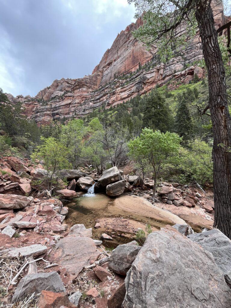
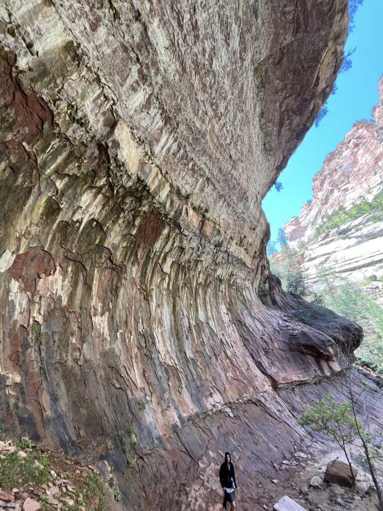
Enjoy a relatively flat start to the trail before the world suddenly drops away into the vast canyon. The magnificent Zion cliffs and rocks surround you as you complete a steep descent to the canyon floor. Take caution, there are loose rocks, some step downs, and the distraction of the views around you.
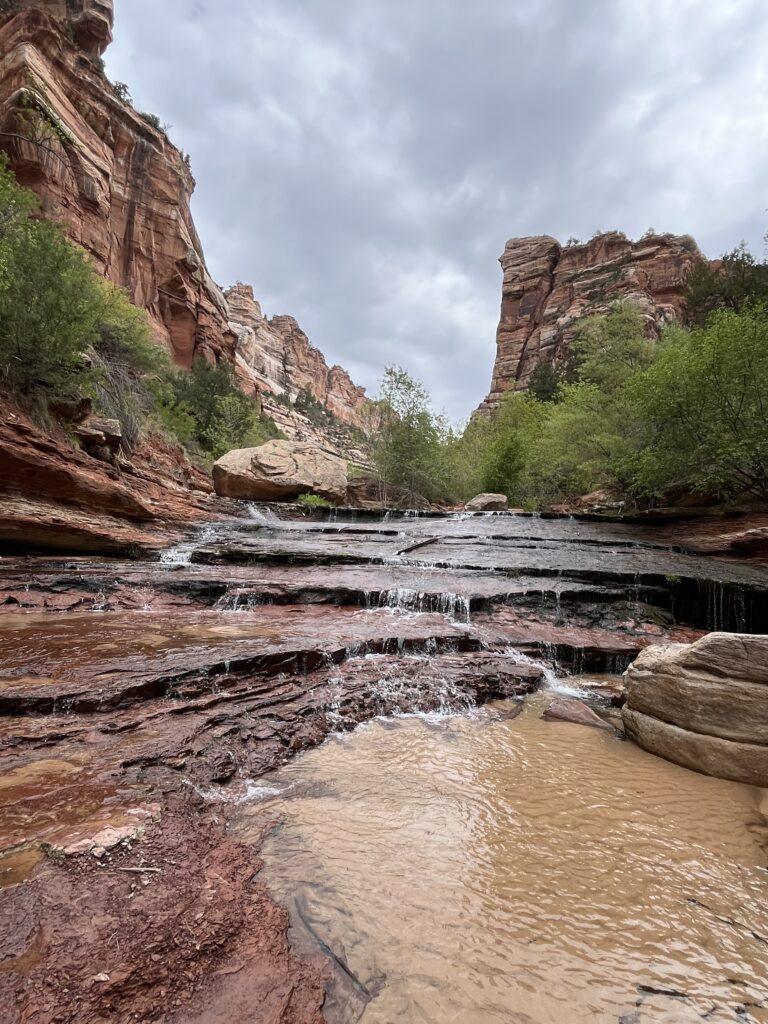
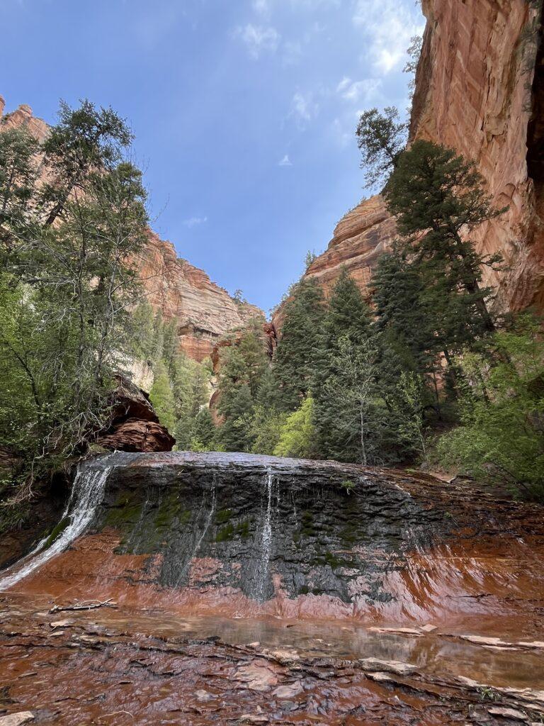
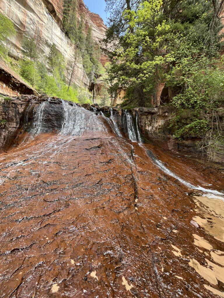
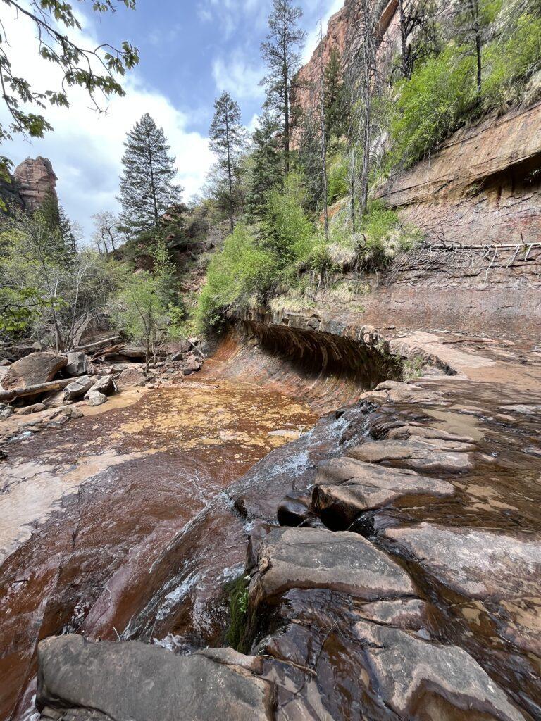
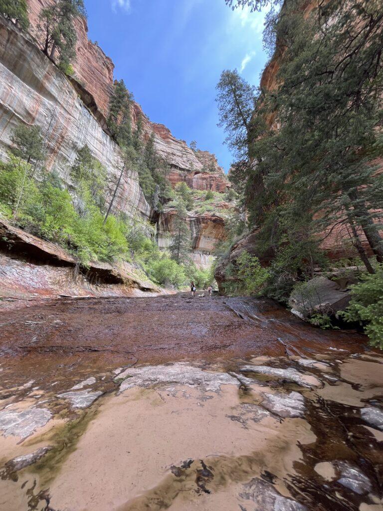
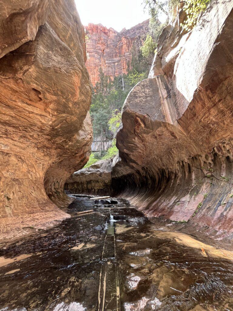
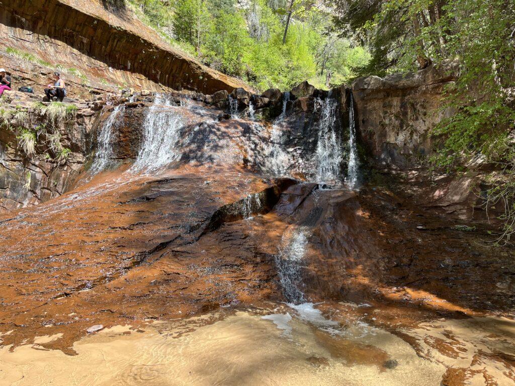
Once on the canyon floor, you will have multiple water crossings as you follow the trail. At some point, embrace the water and walk right through it. By the time you reach The Subway, you will be required to walk directly in the water and the creek becomes the trail. There were several sections of rocky scrambles, but nothing that requires technical skill or equipment. There are several small waterfalls, as well as the beautiful Archangel Falls.
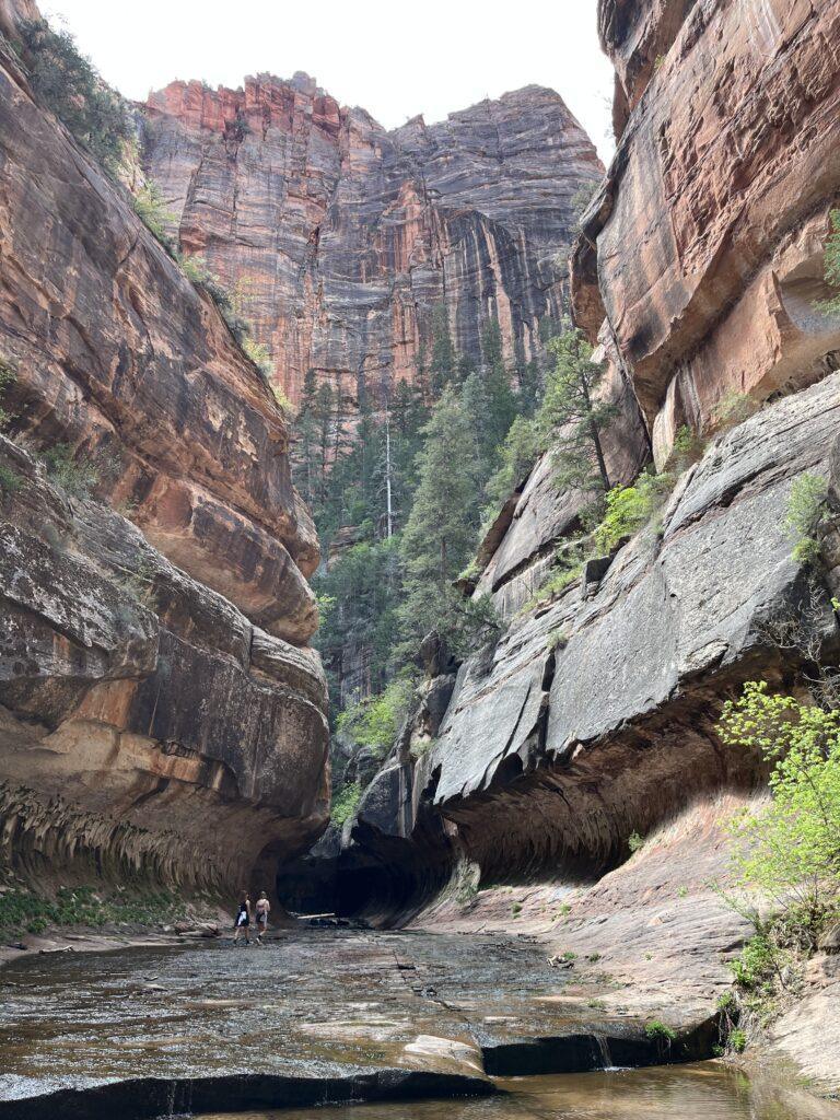
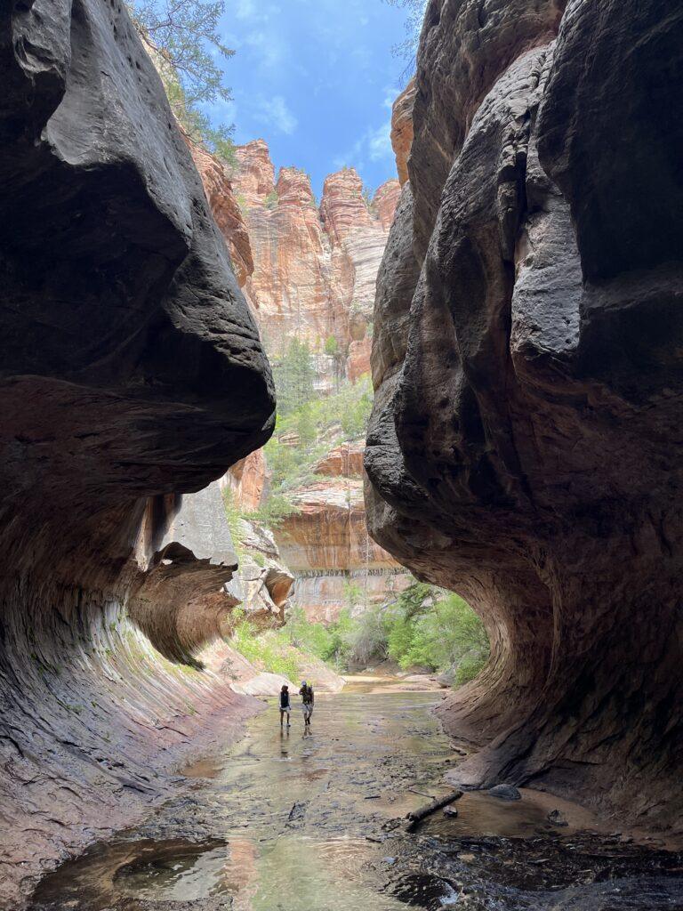
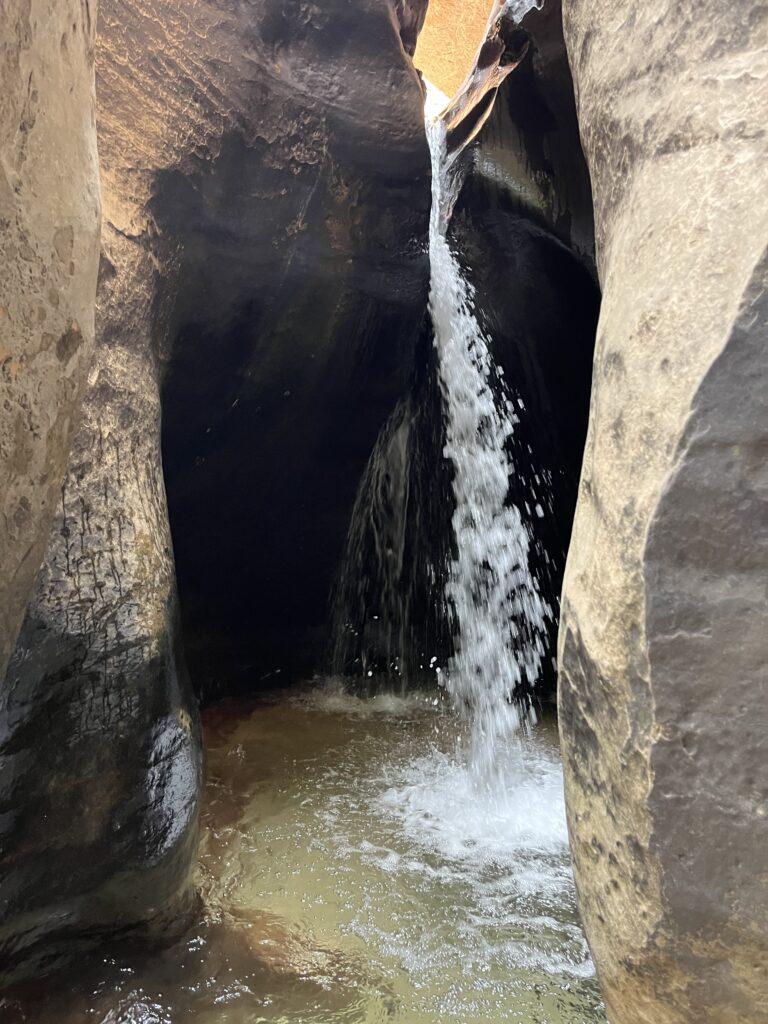
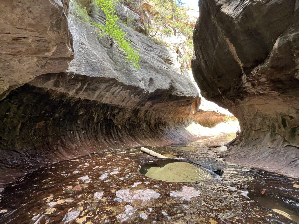
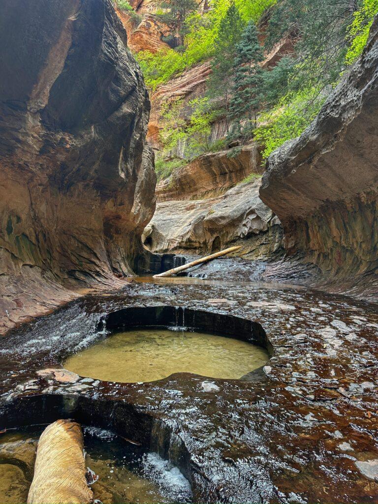
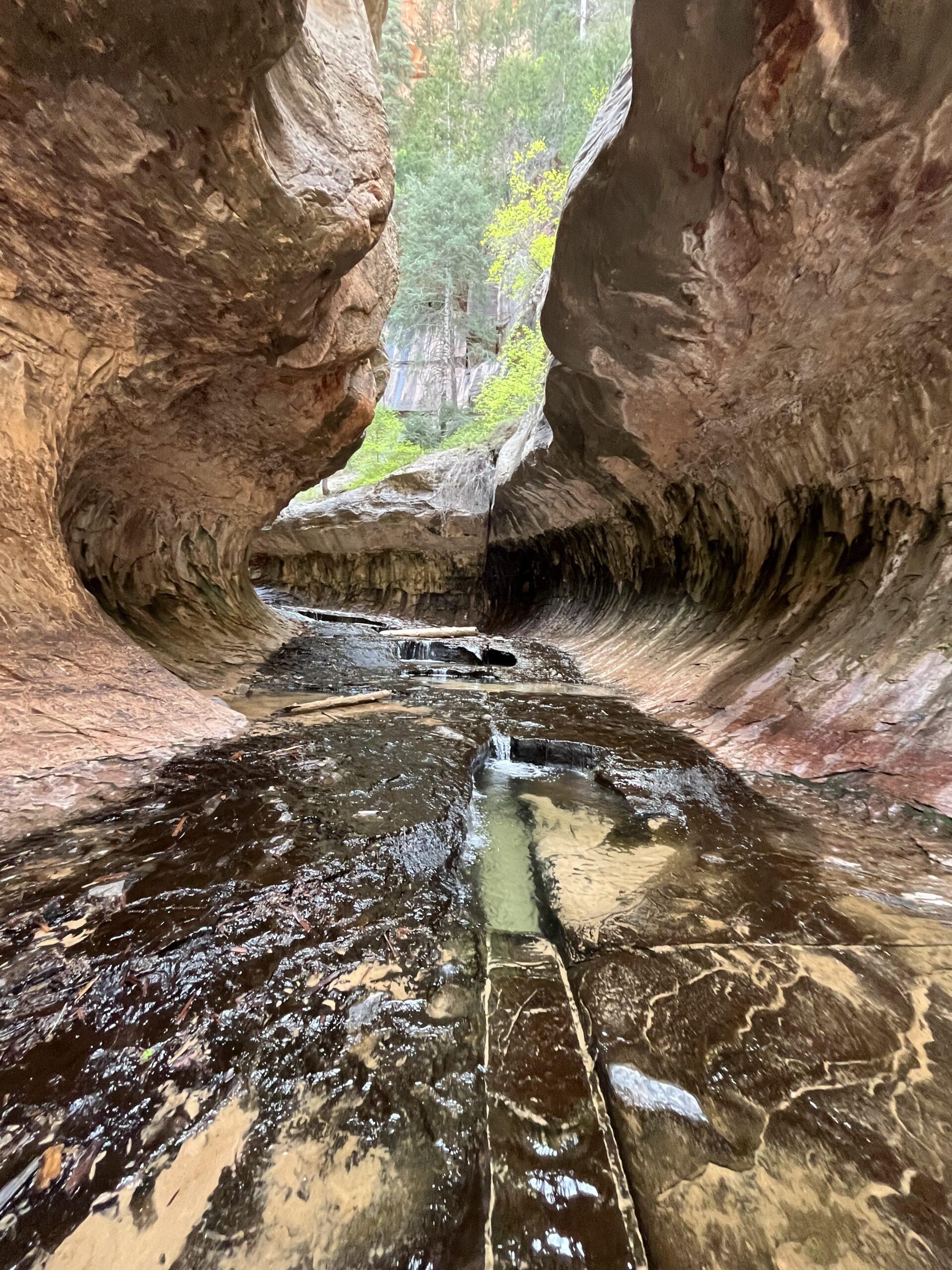
After meandering through the canyon and creek, the walls begin to narrow. Suddenly, The Subway appears. It looks just like a subway tunnel. Through The Subway, water pours into pools, creating even more dramatic contrast with the curved walls, blue-ish pools of water, dark and light colored rocks. We hiked a little further and went into the deeper water to see the waterfall just past The Subway.
I wore neoprene socks with Keen sandals. The water was cool and I was glad for the neoprene socks with the amount of time we spent in the water. I changed into my hiking shoes and dry socks for the hike out, which worked out great.
Lastly, the hike out. It is about a mile of very steep hiking out. This part was tiring, but not impossible. The part that made it more of a challenge were the intermittent larger rocks you had to step up onto, which wrecked my rhythm for trekking out. It was a good workout and a sense of accomplishment to reach the top!
Tell Me More
Difficulty: Strenuous, related to steep descent in and steep ascent out, as well as stream crossings and rock scrambling.
Trail Stats: 7.2 miles, out and back, 1,348 feet elevation gain per AllTrails. Our group completed this in just under 6 hours, which included time to take pictures, frolic in the water, change shoes, and a snack break. Our mileage was 8.24 miles. The park tells you to expect a 6-10 hour hike.
Trail Finding: The trail is clear going down/coming up. Once you are by the river, it is unclear at times. The Park Rangers encourage you to just walk right in the water where able, since the water leads to The Subway.
Conditions: Sand, loose rock, packed dirt, water, slippery river rock, boulders, this trail has about every type of surface you could hike on.
Would I Repeat This: Yes, what a treat for your birthday or otherwise!
Let’s Do This
Parking: Small lot available at the trailhead.
Timing: I would take caution of hiking this if rain is forecasted. In addition to the Subway itself, there were numerous places that I would not be excited to be in if there was flooding. I would recommend an early start if you can help it, you will have less people around and less heat for the strenuous hike out.
Downloaded Map: Yes, definitely have the map downloaded.
Fees: You must secure a permit through Recreation.gov, see the link below. Search ‘Zion Left Fork North Creek (Subway) Seasonal Lottery. There is an advanced date lottery, as well as a daily lottery that is two days in advance. Please note, you must pick up your permit in person at the Wilderness Desk at the Visitor’s Center in Zion National Park. This can be done the day before or the day of your hike.
This hike is within Zion National Park. You will need to have your pass or proof of fee payment on your person during the hike. You will also need to present your pass or pay the entrance fee when going into the park to pick up your permit.
Be aware that the top-down approach is a canyoneering route, requiring technical skills and equipment.
Also of note, do not drink or attempt to filter the water due to potential for Cyanobacteria.
Nearby Fun
Trails: Left Fork Falls, Hop Valley to Kolob Arch, Kolob Reservoir, and more.
More Photos