Rattlesnake Creek and Ashdown Gorge
Description
DESCRIPTION
After three seasons of attempting a backpack excursion along the Rattlesnake Creek and Ashdown Gorge wilderness trails, we were finally able to check this one off our list. It was worth the wait! Thanks to a basically non-existent monsoon season, good night time temperatures, and an open weekend, we had a window of opportunity the first weekend of August and finally, finally completed this adventure.
We completed this as a shuttle, top-down excursion. We left a vehicle at the bottom/Ashdown Gorge trailhead. We drove to the top and embarked at the Rattlesnake Creek Trailhead. Once we reached the bottom the next day, we drove back up to the top retrieve our other car to head home.
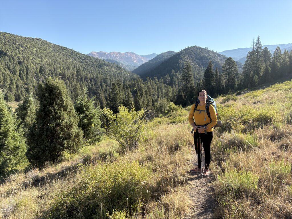
You will begin your hike at in an alpine environment at nearly 10,500 feet. Pretty immediately after setting out, you can take two very short spur trails on your left that will take you to views of the Cedar Breaks National Monument amphitheater. You will continue downward and wind through aspen and pine groves, with fragrant ponderosa pines sprinkled in. Be sure to stop and look all around, especially behind you as you descend. The brilliant red and oranges of Cedar Breaks are interspersed with the green of the alpine vegetation.
From what we read, we stopped at the campsite at mile 5. We were not sure if there were camping spots further, so we set up camp there. It was by flowing water for filtration and a relaxing sleeping soundtrack, and rocks and logs to sit on. I wish though it had been a bit further into the hike since it left more mileage on day two when we were trying to finish the hike and get home. For reference, there are two decent spots further down trail that would have worked out as well if you are not with a big group. There is also a stretch of spots at the junction of Rattlesnake Creek and Ashdown Gorge trails, but I feel more apprehensive about camping along the river during flash flood season.
With what we were left for mileage and what we knew we had to do for day two, we decided to attempt to get the two waterfalls in the evening. I am glad we didn’t continue on from where we said, “okay, time to turn around because we will run out of daylight and energy”. Seth was smart and got out the drone to scope out the two waterfalls. Water levels were low and from what we could see, the two waterfalls, Lake Creek Waterfall and Snake Creek Waterfall, were mere trickles. Not unexpected given the very dry season Utah is having and low water levels of the creeks. We headed back to camp for the evening. We now have another reason to head back to do Ashdown so we can lay eyes on those waterfalls.
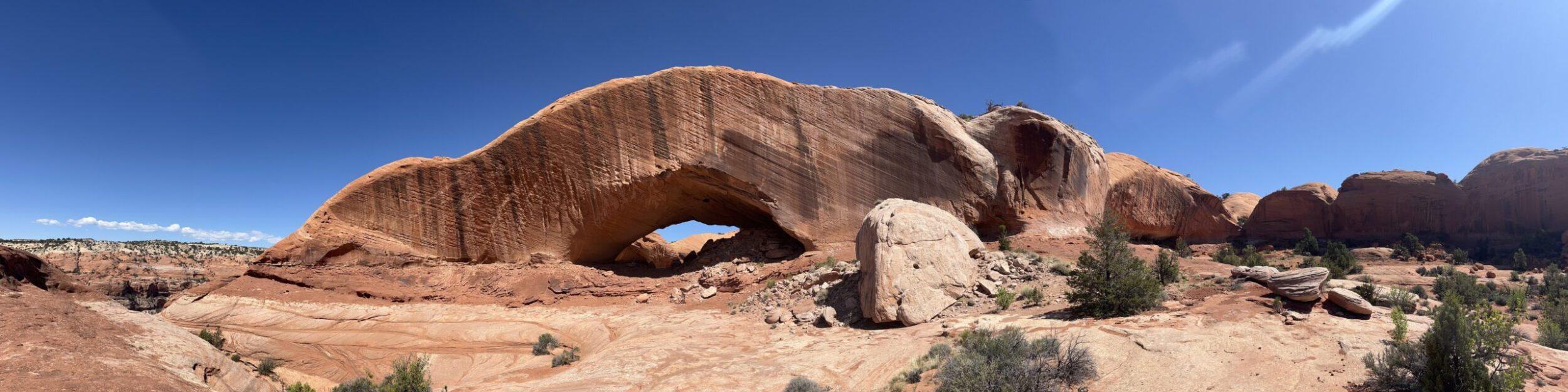
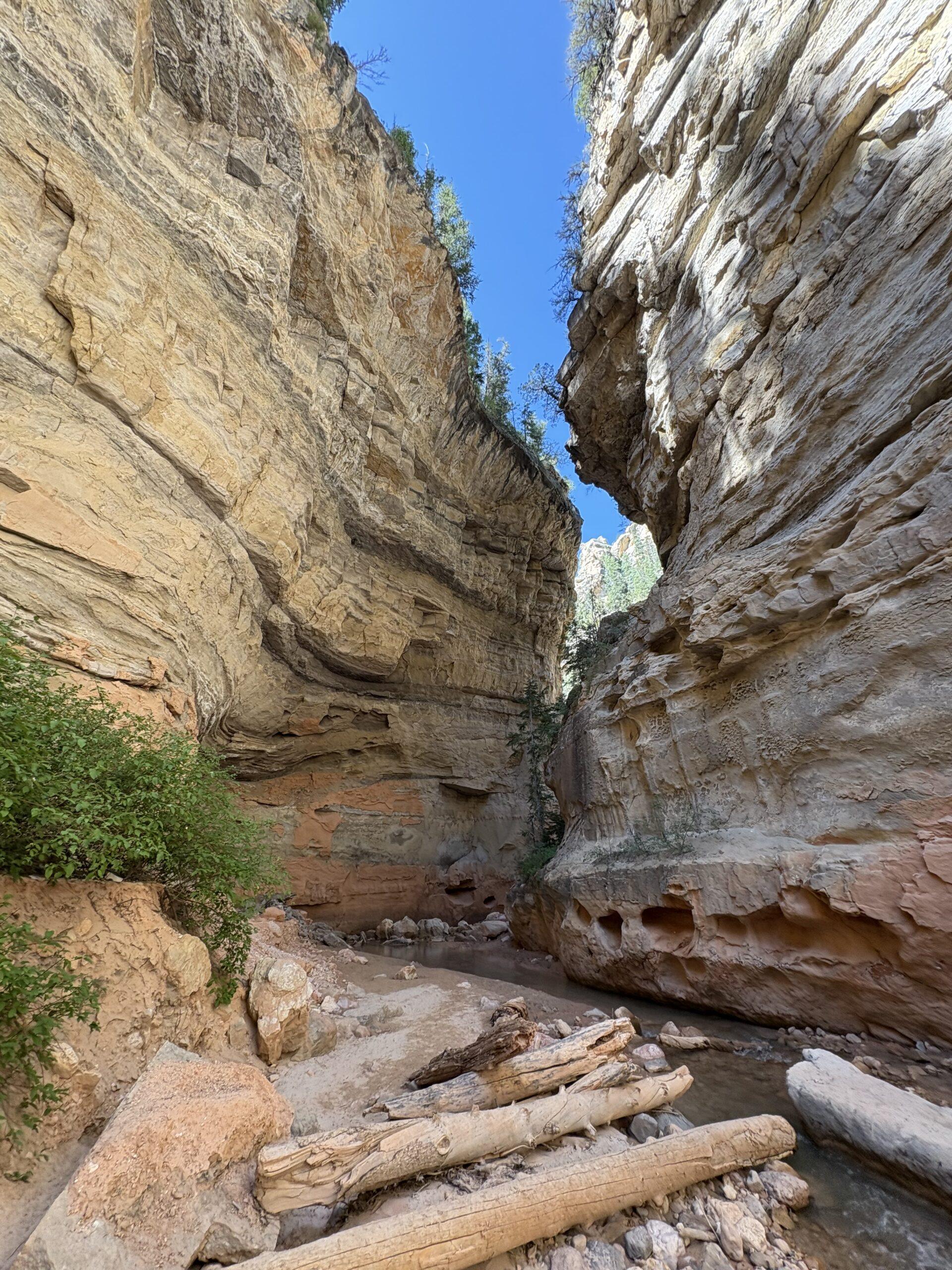
Day two was our exit out via Ashdown Gorge. Tip for this hike, whether doing top down or Ashdown only, embrace the wet feet. You will have to walk through the water and many times at that. Just get your feet wet and have fun with it. We recommend trekking poles for stability with the rocks and it allows you to keep your pace. The gorge is a stunning place. If you enjoy the Narrows, you will love this. The white rock walls soar above you as you walk along and through the water, following the creeks path as it heads down the canyon. Keep an eye high up for Flanagan Arch, it is easily missed. Also, if you like rock hounding, know that all of the multicolored rocks littering the ground the entire trail/waterway will tempt you and slow you down when you stop to look at them every other step.
Note: Be aware that drone use is permitted in Dixie National Forest, but not within Cedar Breaks National Monument (see map under ‘Tell Me More’ for general reference of those boundaries.
Tell Me More
Difficulty: Moderate to strenuous.
Trail Stats: I have seen varying reports on this. The attached map below lists 9.5 miles one way, from top to bottom with a difference of 3,400 feet of elevation. AllTrails lists Rattlesnake Creek one way mileage as 6.4 miles, and the Ashdown Gorge section one way as 4.1 miles (this includes the extra section to the waterfalls).
Based upon my tracked data, the Rattlesnake Creek section for us was 7.1 miles. The Ashdown Gorge section was 4.92 miles one way (without adding the waterfall spur).
Trail Finding: Relatively clear. I would recommend the downloaded map. Most of the trail was clear, but there really are no signs or markers for way-finding if needed.
Conditions: The Rattlesnake Creek portion of the trail is packed dirt and some loose rock. Once you enter the Ashdown Gorge portion it is water, water, rocks, more water, more rocks, and some sand, and a little more water and rocks.
Would I Repeat This: The Rattlesnake Creek portion, for the time and work of the shuttle, probably not but I am very glad we had the experience. The Ashdown Gorge portion, for sure! This part rivals the Narrows and is already a repeated hike for us.
Let’s Do This
Parking: Parking is available at both trailheads.
Timing: Depending on your propensity for cold weather camping, there is a small window for completion of this trail if you are overnighting. The camp locations along the Rattlesnake Creek trail are at a higher elevation and temperatures can dip to be chilly. In addition, keep in mind you are hiking out in water the next day and there is not much sun in the gorge portion. Keep a close eye out on the forecast, you do not want to be doing this hike during rain and potential flash flooding.
Downloaded Map: Yes, I recommend it.
Fees: None
Nearby Fun
Trails: If you are in the area of Rattlesnake Creek Trailhead, you must visit Cedar Breaks National Monument. Trails include Bartizan Arch, Rampart Point, Sunset Trail, Spectra Point, and Alpine Pond.