Longbow Arch
Description
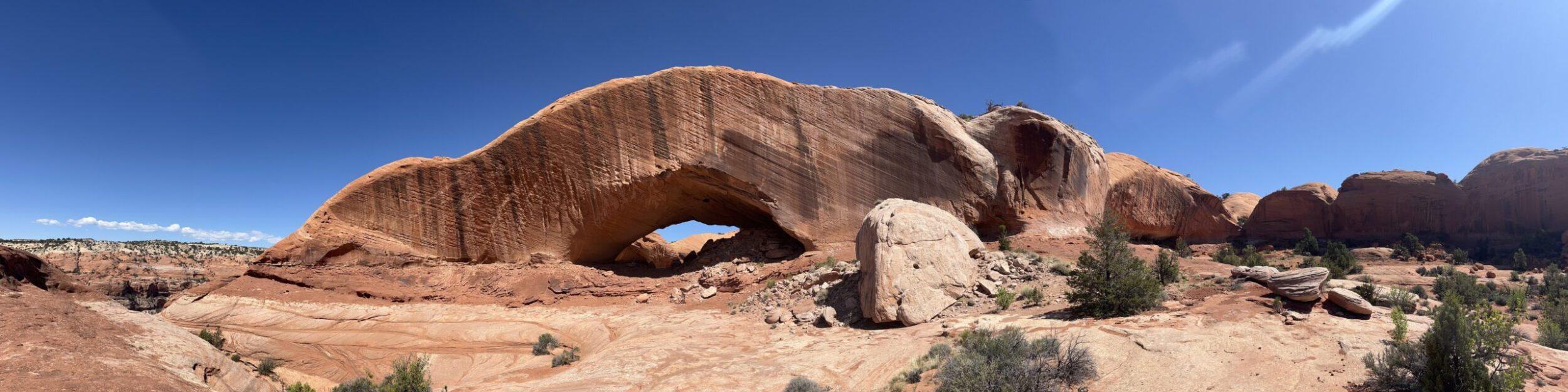
Longbow Arch is an impressive span outside of Arches National Park. While you can see many, many arches in the park, there are a copious number outside of the park, like Long Bow.
Travel along the mighty Colorado River on Potash Road. Be sure to stop at the petroglyphs on the rocks. Once at the parking lot, head up the hill on the north side of the parking lot if you are up for a scramble of loose rocks. You can see some dinosaur tracks before you start your hike to Longbow Arch.
The initial climb was relatively steep. We enjoyed the scramble up to get to the top of the mesa area. You will hike on the sandstone and patches of sand until you reach the arch.
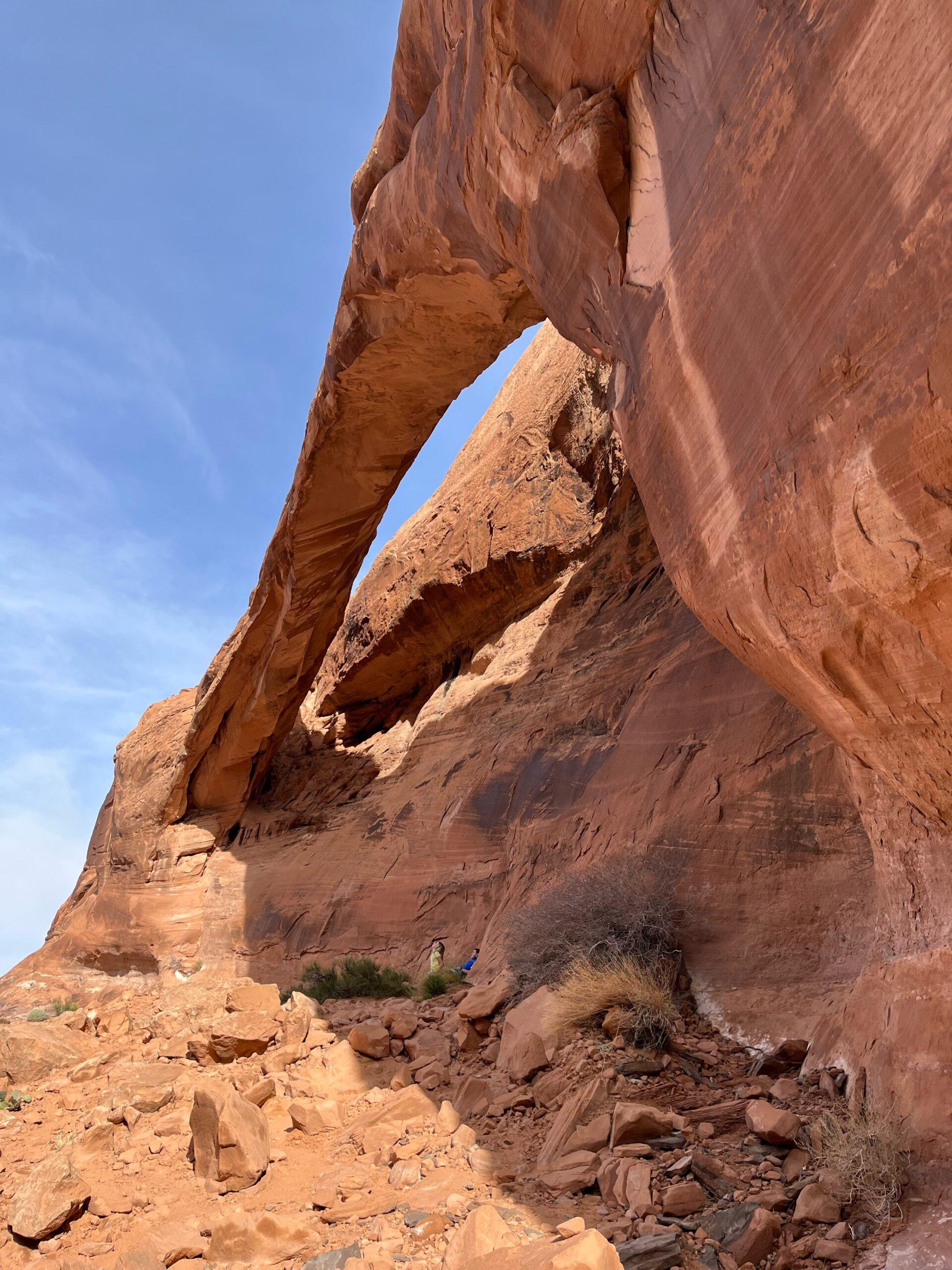
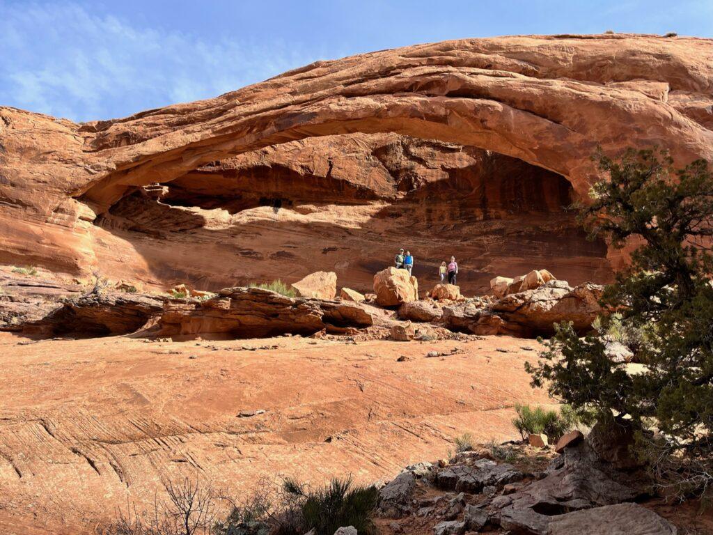
The trail curves around a corner and the narrow expanse seemingly appears out of nowhere. Be sure to go under the arch and appreciate how much larger it truly is once you are next to it.
Tell Me More
Difficulty: Moderate.
Trail Stats: 2.3 miles, out and back, 442 elevation gain.
Trail Finding: Not always the most clear, have your downloaded map on hand.
Conditions: Some loose sand, sandstone, a short scramble or two.
Would I Repeat This: Yep!
Let’s Do This
Parking: Parking lot present.
Timing: Limited to no shade, take this into consideration with your timing for this hike.
Downloaded Map: Recommended, it is helpful to have for this one.
Fees: None.
Nearby Fun
Trails: Corona Arch, Poison Spider, Mill Creek, Arches National Park, and more.
More Photos


