
Havasu Falls
Description
Havasu Falls. It has been a dream of mine for years. Havasu Falls is not just a hike, it is a multi-day adventure that will test your physical abilities. It is a trip of a lifetime.
We completed this hike at the start of June. We had another trip immediately after returning. Since we have been back, I have had a hard time getting started on this post. I just don’t know where to even start! This is, by far, the most extensive hiking endeavor we had set out to do, and was one of the most rewarding. How do I begin to describe it all to do it justice?!
Let’s back up to start. In January, our bestest outdoor adventure friends reached out with an unbelievable invitation. They had been selected for the lottery for Havasu Falls Permits and had two additional spots to offer to Seth and I to come with. This was not a hard sell for us! To not only get to finally get to do the Havasupai waterfall hikes, but to do so with dear friends, this would be a trip we would never forget. Our friends are both very capable outdoors people, and people we laugh hard and often with, so we were insanely excited from the start.
Havasupai Falls, also known as Havasu Falls, is actually a series of waterfalls. They are located on the land of the Havasupai Tribe, just adjacent to the Grand Canyon. The permit and its associated regulations are through the tribe. Keep in mind, this is the Havasupai’s land and you are a guest there. Please respect the privilege of being allowed to be on it. Read the rules, pack it in and pack it out, and remember no photos of the village, residents, or their animals.
Once we were officially going, we spent the next five months doing every verb possible associated with getting ready. I don’t think a day passed that we did not do something to prepare, scheme, research, collaborate, and plan. We hiked nearly every day to prepare ourselves, including wearing our backpacks to get used to some of the weight and the fit. We have a steep 4×4 hill near our house and the neighbors probably thought I was crazy for all the times I walked up and down it over and over since January to get some steep incline preparation. Anything you can do to work on inclines, I suggest it. Also, work on some distance hikes that have decent elevation gain. We did two longer hikes, 8 miles and 11 miles each close to when we were leaving, and both with fully loaded backpacks. This allowed us to train and also to assess our physical abilities. I felt ready after doing the 11 mile hike with more elevation gain than Havasu and feeling pretty good after. I estimated hiking approximately 150 miles to get ready for this trip. We are lucky to live where we could also train at a similar elevation and desert conditions, this was definitely helpful.
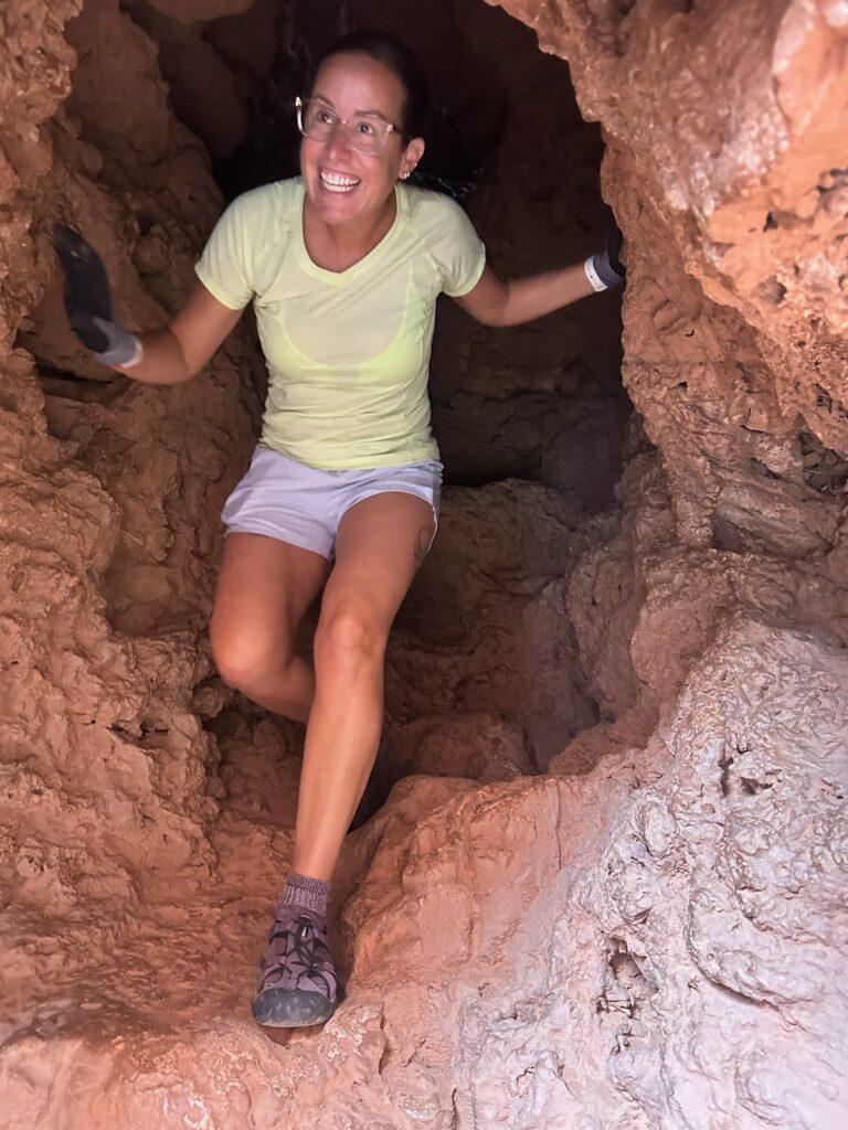
Packing. My pack landed at 25 pounds, packing in two liters of water. I did bring a sleeping bag. I highly recommend joining a Facebook Havasu Falls group. There is daily intel on the hike, camping, and tips for packing. Seth and I split MSRs with added protein, had freeze dried fruit, protein cookie bites, jerky sticks, Clif Bars, and Shot Blocks, and don’t forget instant coffee. There is access to fresh drinking water from a spring mid-way through the campground. We brought our Ketadyn just in case we needed to filter water. A few other odds and ends I recommend bringing – hand sanitizer and extra toilet paper (sometimes the composting bathrooms were out of these items), moleskin for any blisters, extra vessel to hold water to reduce trips to the spring. I also brought my own grip gloves for Mooney Falls, which I was very glad to have brought.
Two days before we were to start our trek in, there was a bad flash flood, causing devastation to the campground and flooding in the village. The flood actually eliminated two of the five falls we were hoping to see when the river rerouted itself. There was limited information coming out and conflicting reports on whether there would be a drinking water source. We decided to postpone the trip by one day to allow the storms to pass through for our safety and to verify water availability. Instead of spreading the hiking and exploring out over four days, we squeezed our adventure into three. Actually, even less than that because we were out by Sunday morning.
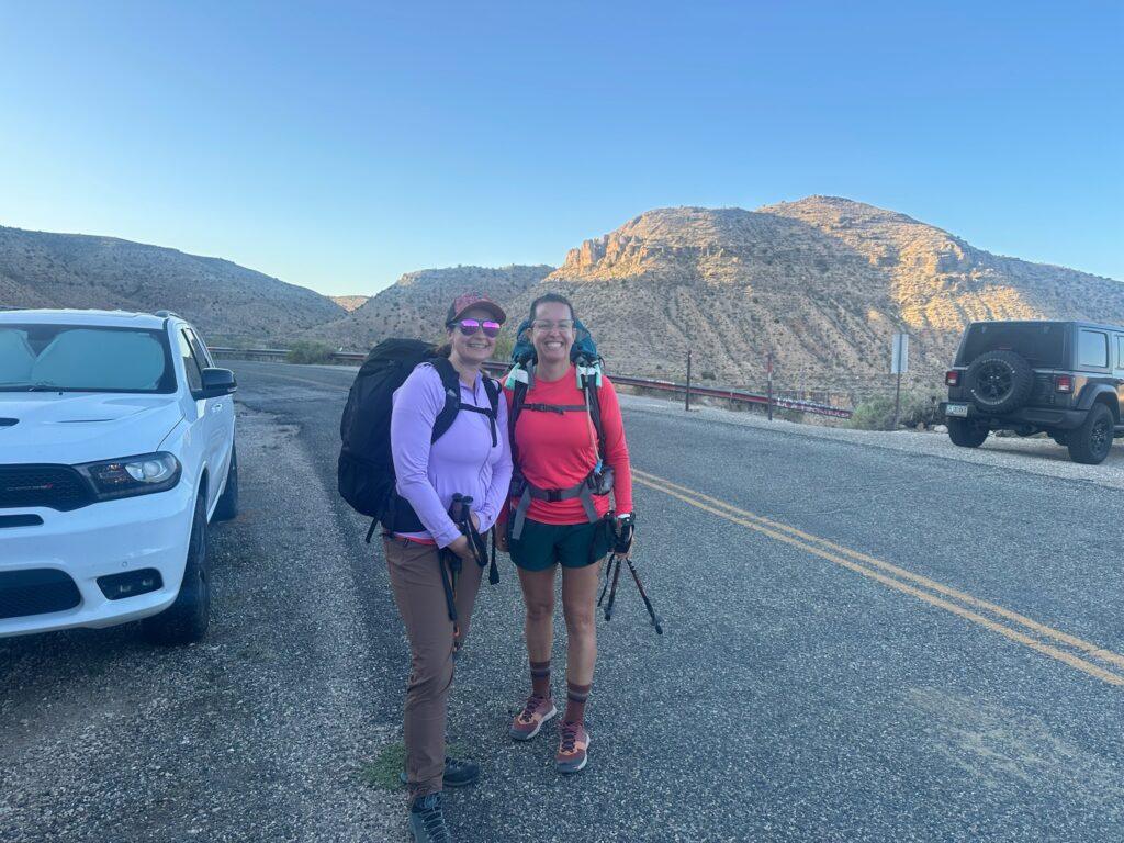
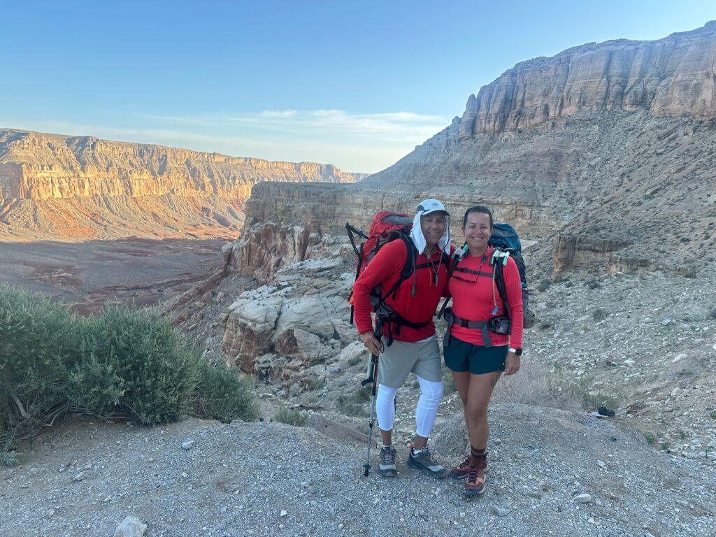
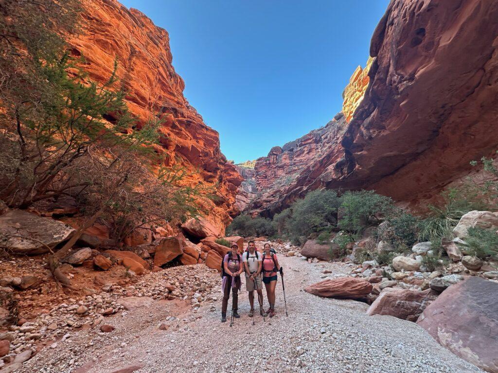
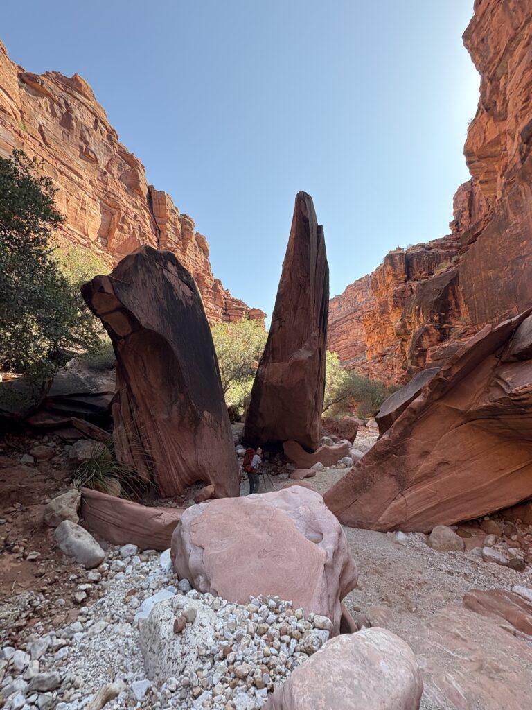
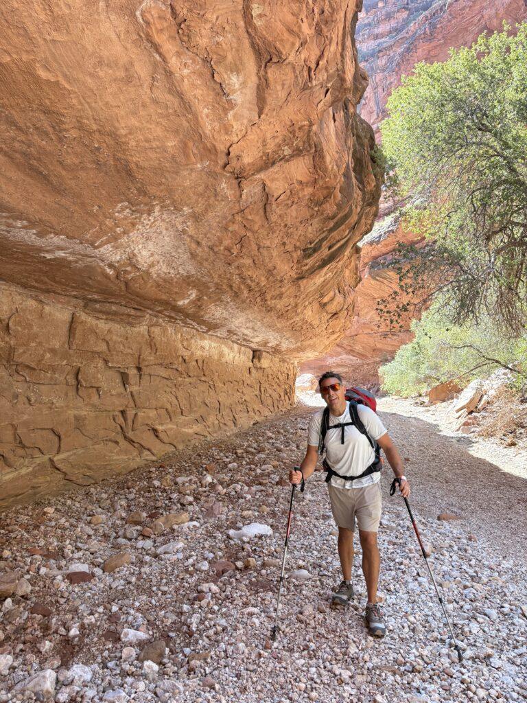
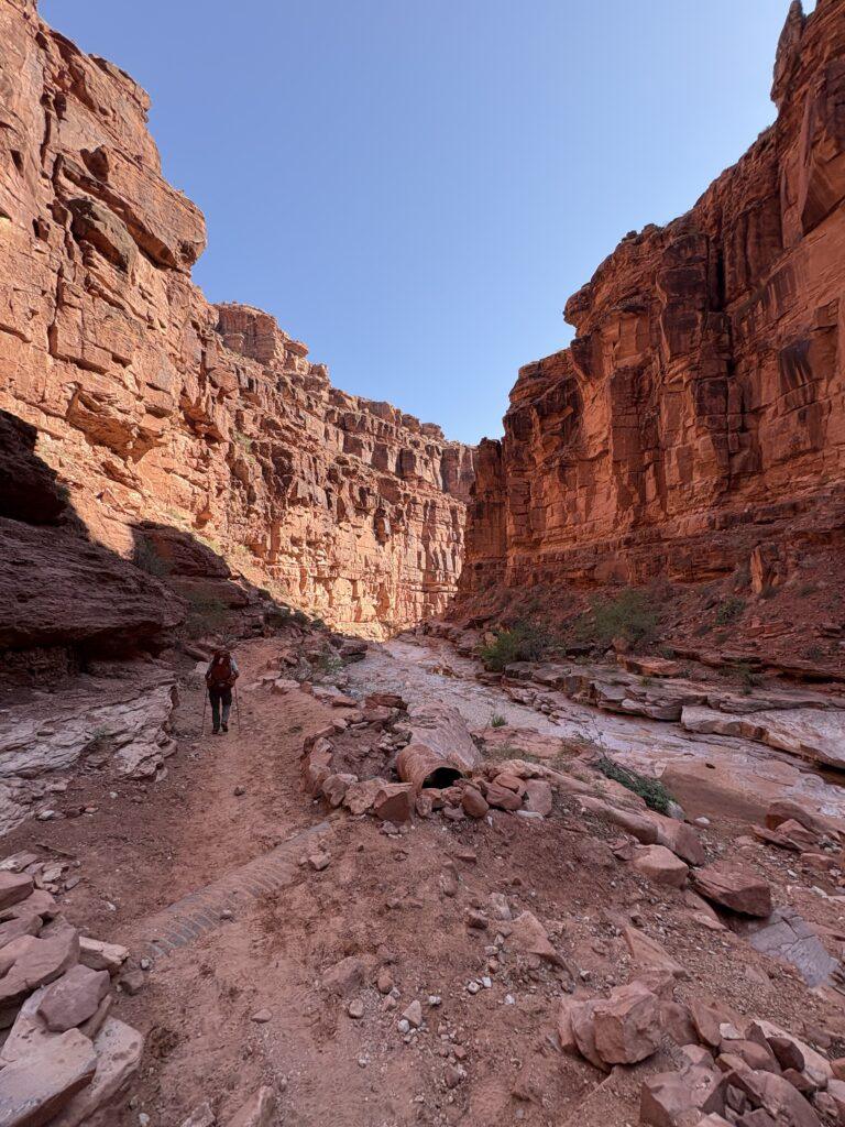
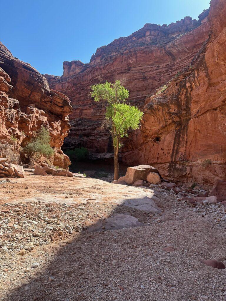
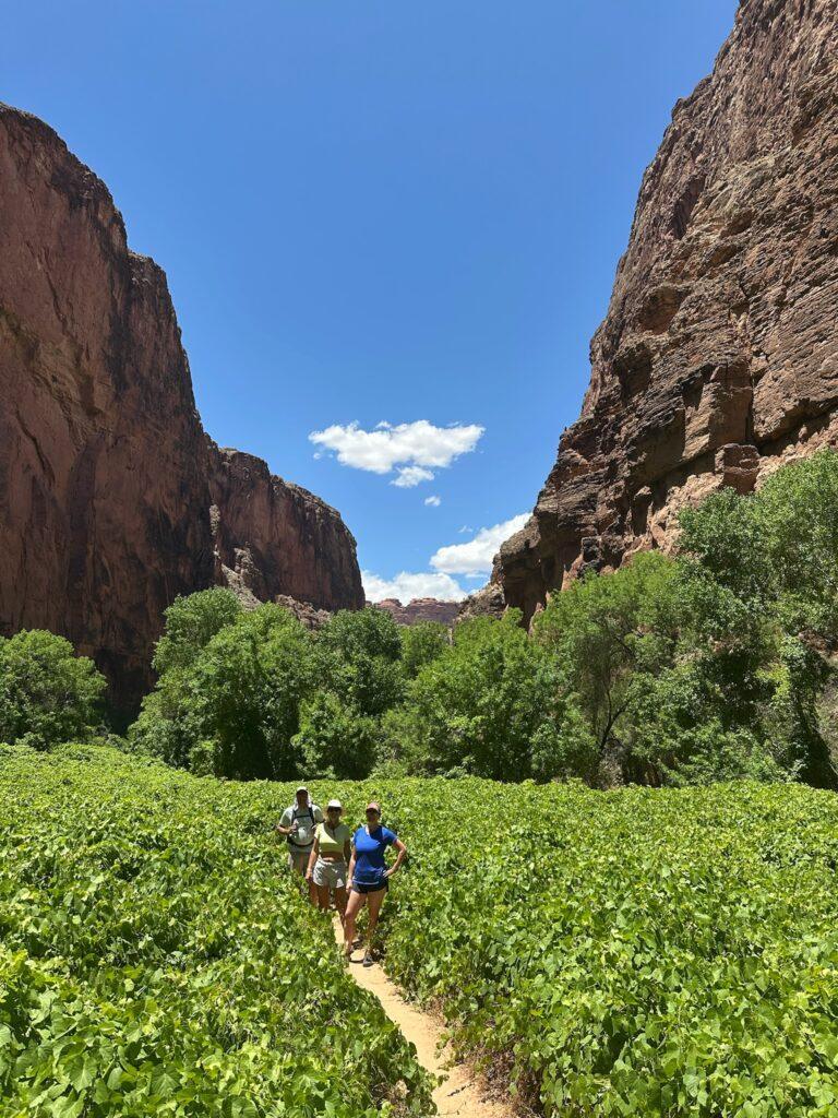
The hike in. I don’t think you will have ever found me happier at a trailhead than on this day. After all of the anticipation and then thinking we may be couldn’t go at all, I had so much joy to be there and putting my pack on my back. I will admit to having a few tears of happiness well up. Looking out over the vast canyon from Hilltop and knowing we were going down to the canyon floor and onward for miles and miles was an exciting feeling. Conversely, it was daunting to have a sense of seeing what the return hike would be like. You drop elevation quickly as soon as you leave the trailhead. Continue onward after the switchbacks and you will be within canyon walls. I was surprised at the beautiful scenery the entire hike. It went by quickly because there were so many photo opportunities and impressive sights. I also enjoyed watching the mules go by. You must yield to them and they won’t stop for you, get out of the way when you hear them coming!
Once you are at the camping area, it is every man for themselves. Find a spot and set up your tent. Because of the destruction from the flood, options were clearly more limited. There were a lot of people camping closely to one another when you first entered the designated camping zone and close to the drinking water. We continued a mile in and found a fantastic spot along the canyon wall. We had shade in the afternoon, the sound of the river, privacy from the main trail, and even a picnic table! After miles and miles of hiking, having somewhere to sit besides the ground was greatly appreciated.
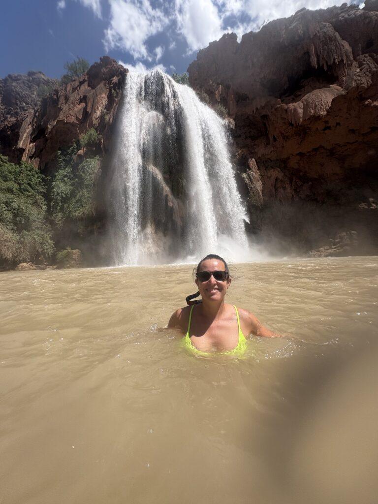
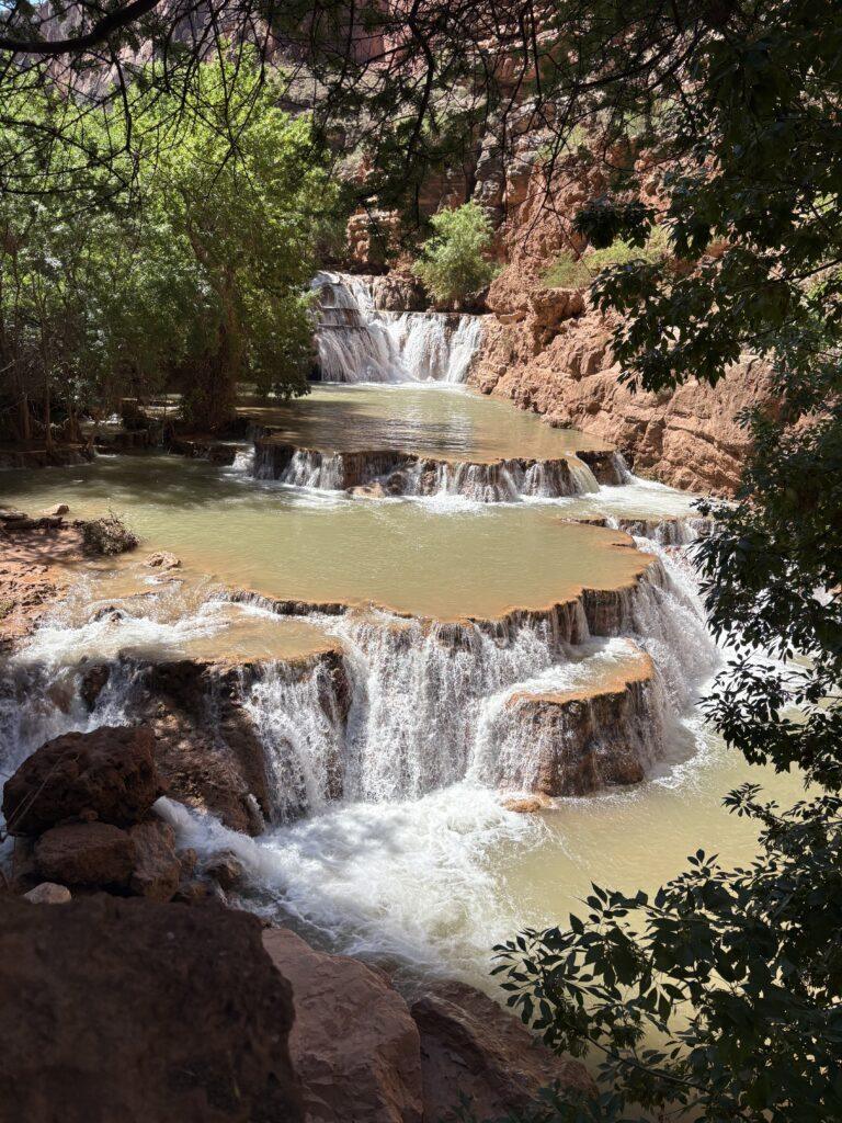
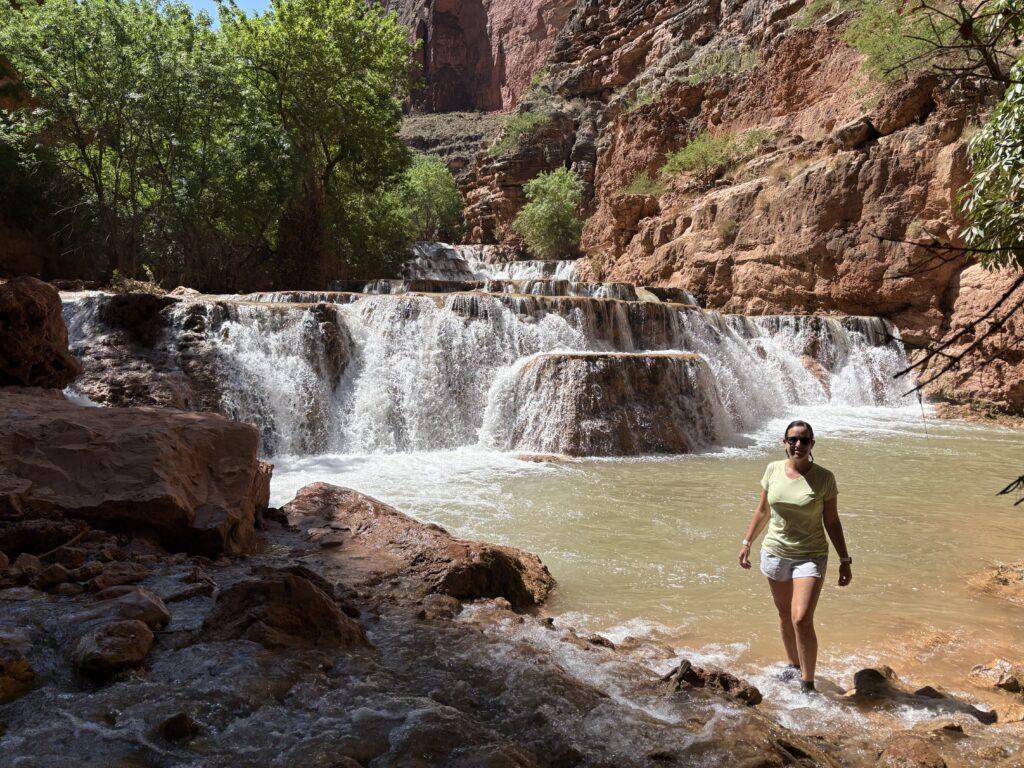
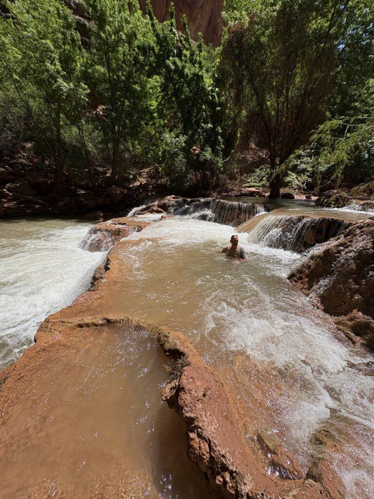
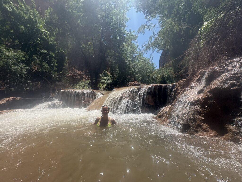
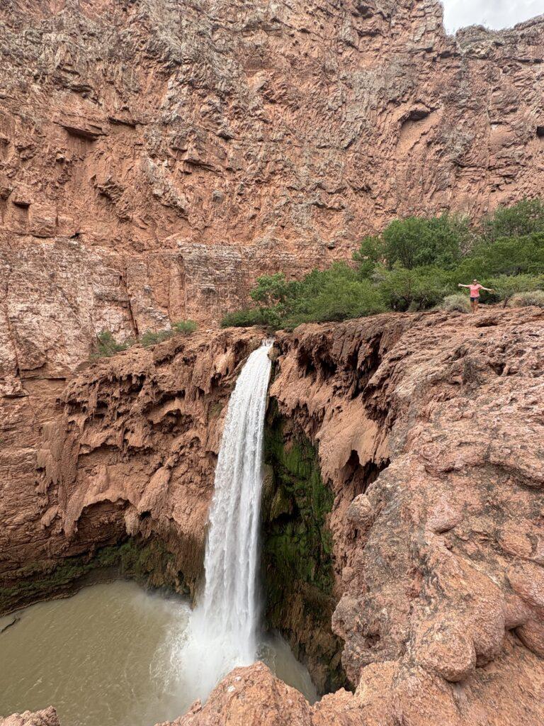
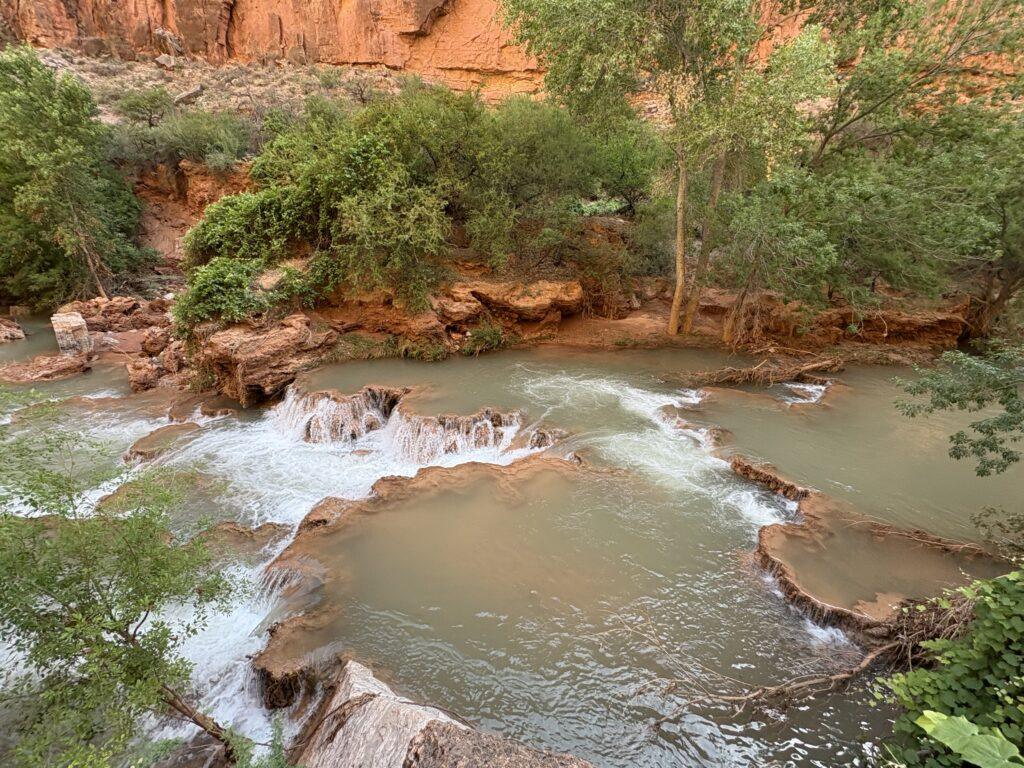
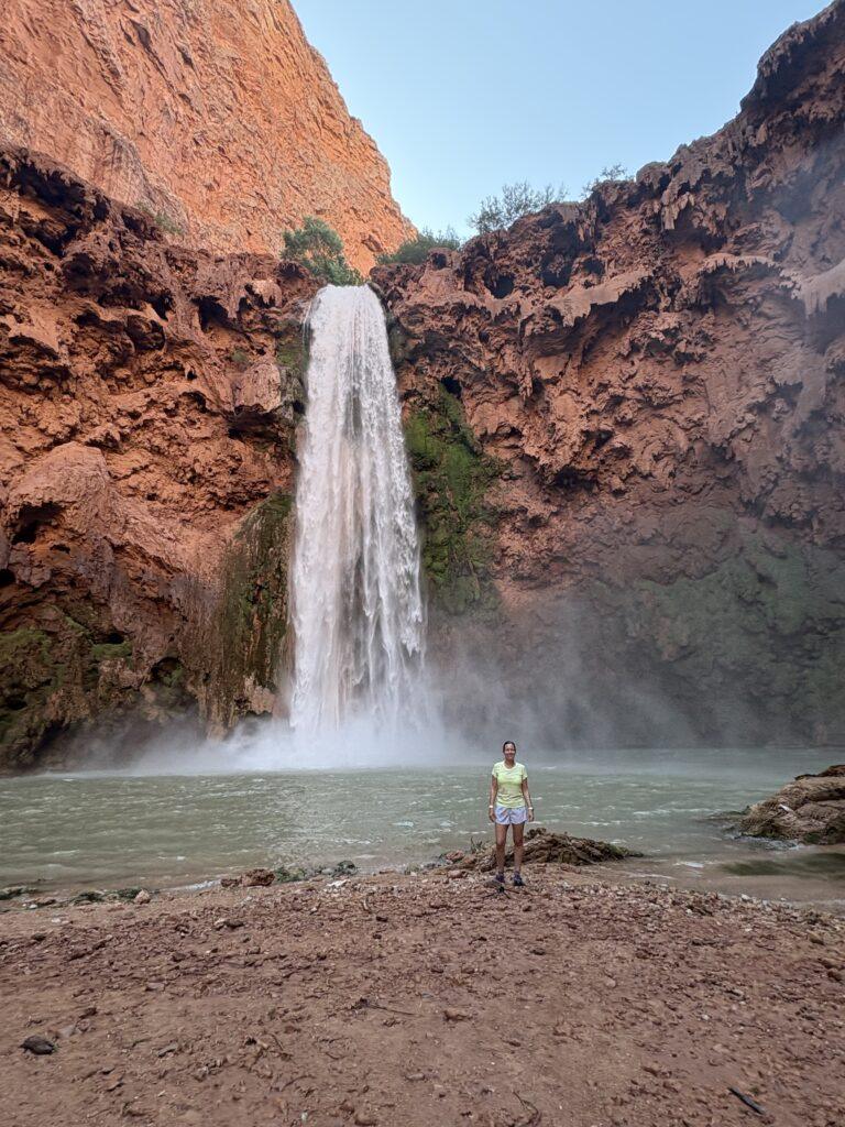
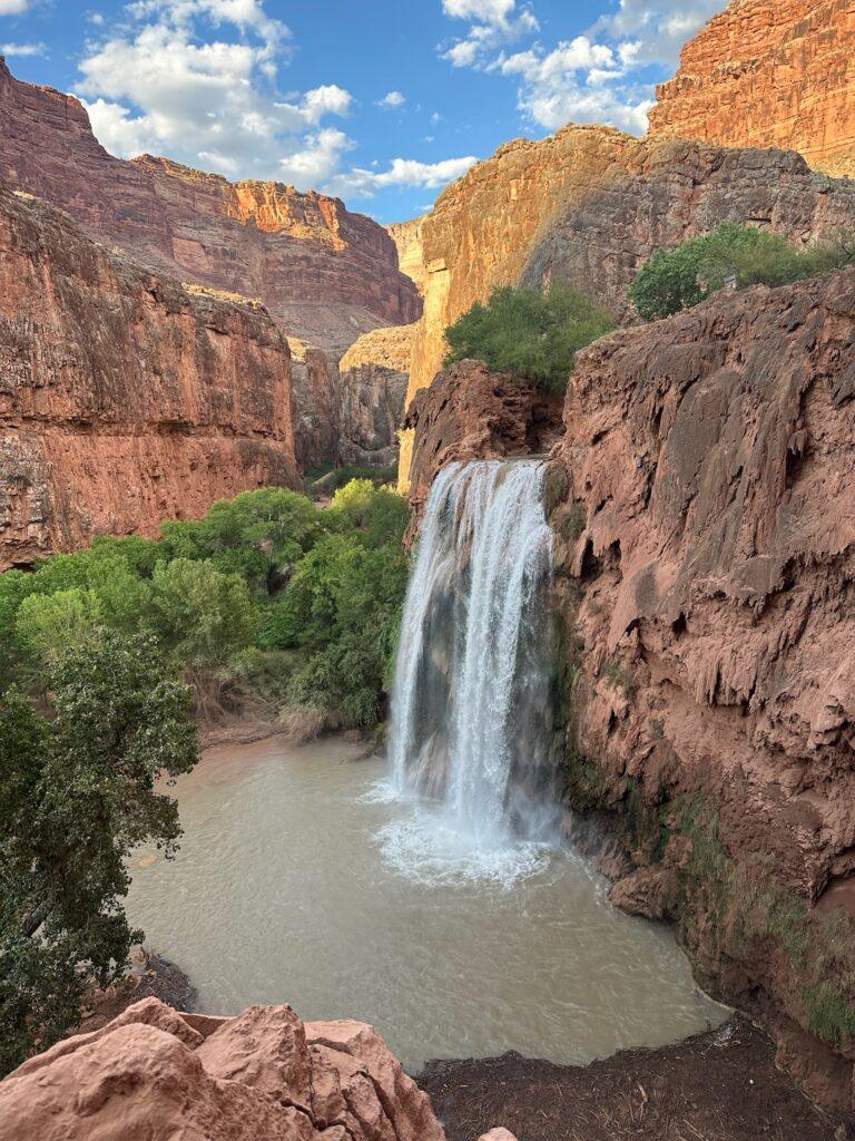
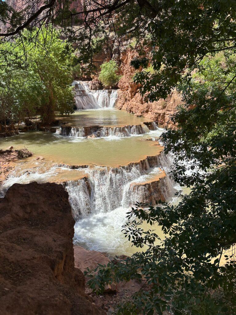
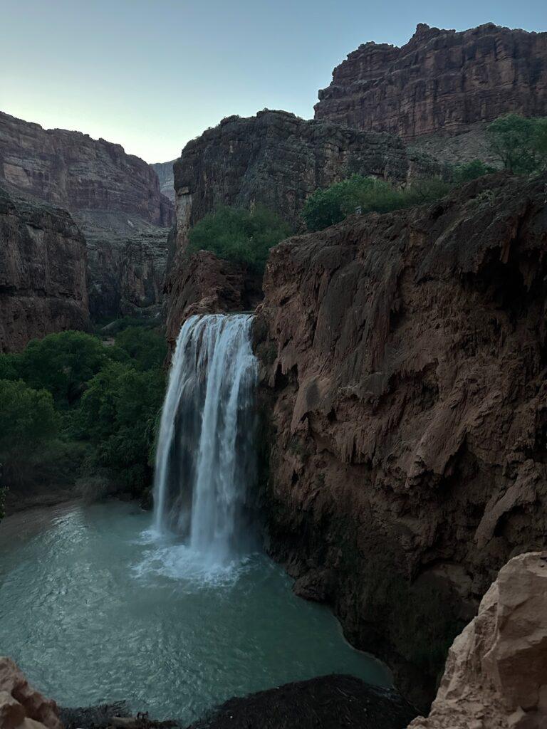
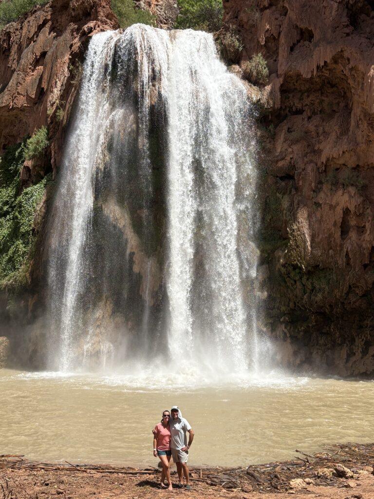
The first major waterfall you will come to is Havasu Falls, which plunges 100 feet into a large pool of water. You can swim in the outer area of this pool. There are also little “pods” you can sit in or on the edge of, formed by lime creating travertine deposits in the water. The next waterfall is the grand Mooney Falls. This is a big one, incredibly loud and powerful as the water pours over the edge and falls 190 feet to the ground below. You actually start at the top of the falls and have to go downward to get to Beaver Falls, more on this in the next section below. After Mooney, continue on the hike, pass by lots of other small rapids and falls, and you will then get to Beaver Falls. This is a series of cascading waterfalls that are fun to walk around in.
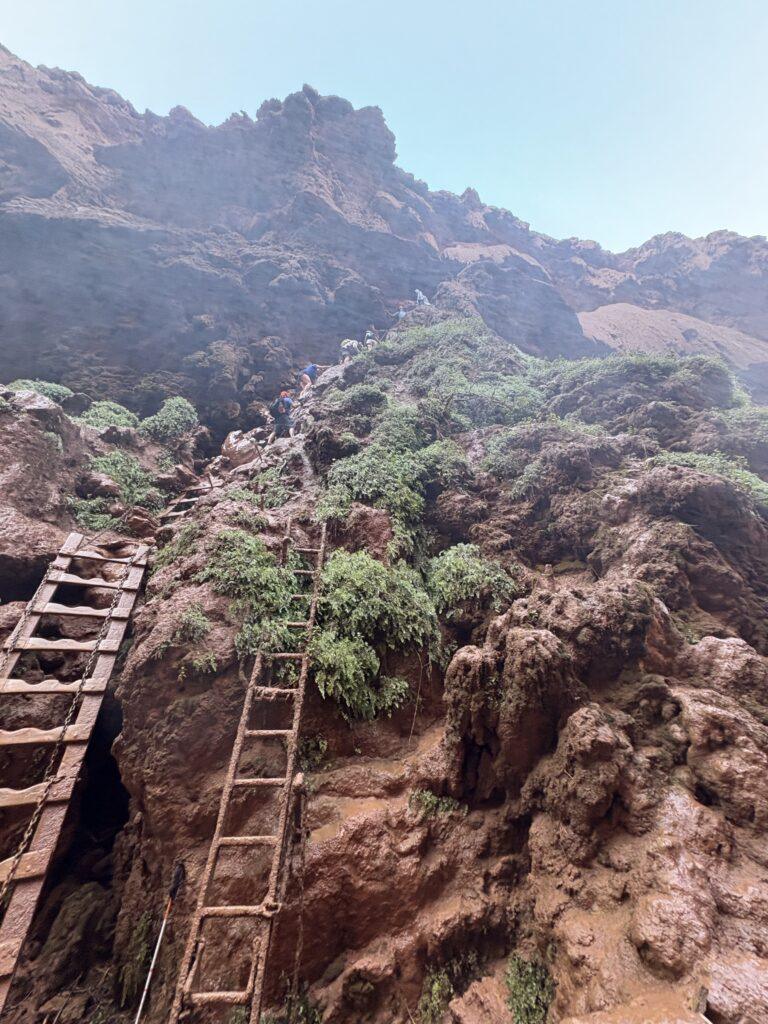
Hiking down Mooney Falls. This is what many talk about. It is intense. Picture starting near the top of a 190 foot waterfall. You slowly start to make your way down an exposed trail and then enter a small person-sized tunnel. Emerge from the tunnel and the trail all but disappears before you. Now you have to go down. This final stretch is near vertical. You will use chains to hold onto as you search for foot and hand holds in the rock. The waterfall will be thundering nearby and spraying you with mist. The chains are wet, the footholds are muddy. I brought my own grip gloves and I was very glad I did to feel like I had a solid hold on the chains. Take your time, keep three points of contact at all times. Have someone confident and more experienced go before you on the descent, then they can talk you through some of the more “blind” spots to next place your foot. For the ascent, I led the charge and felt pumped at the top to have made it and done so without help or coaching. .
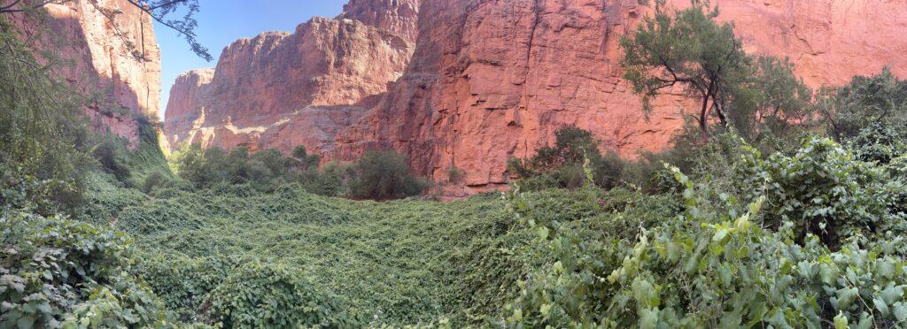
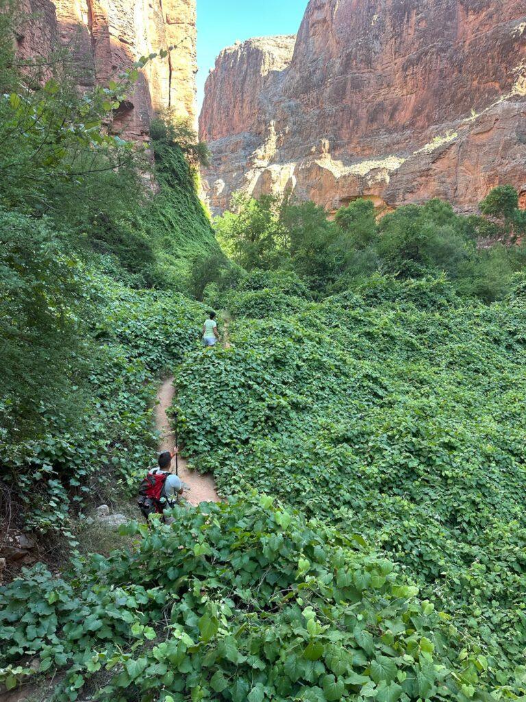
Once you are at the bottom of Mooney Falls, it is time to find Beaver Falls. The hike to Beaver Falls was one of the most serene and unique hikes we have done. There is an ivy that has grown all over the canyon floor and extends up the walls of the canyon. It creates this otherworldly feel, a wall and carpet of lush green.
It was fun going in and out of the water and taking time to sit in the pools and enjoy the sun on our faces and good conversation. There were also a few spots of climbing ladders, one that for sure was not OSHA approved.
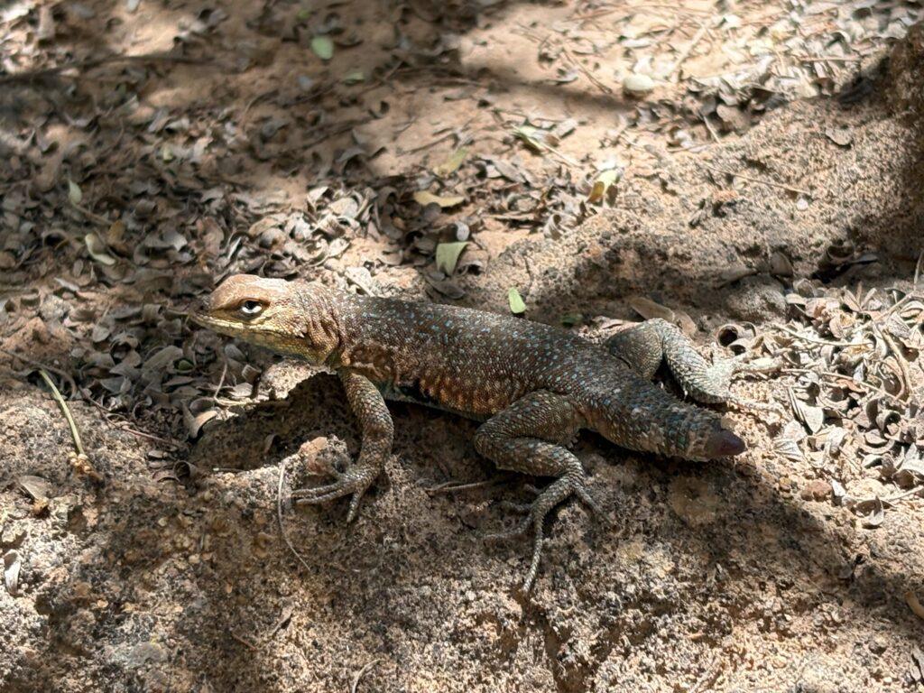
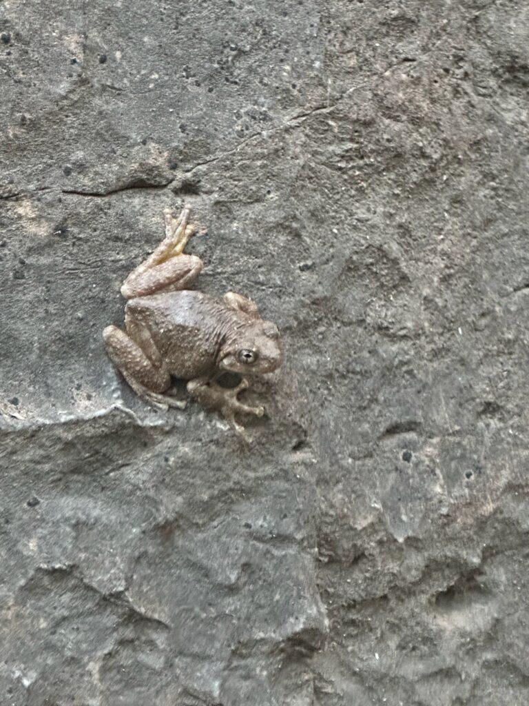
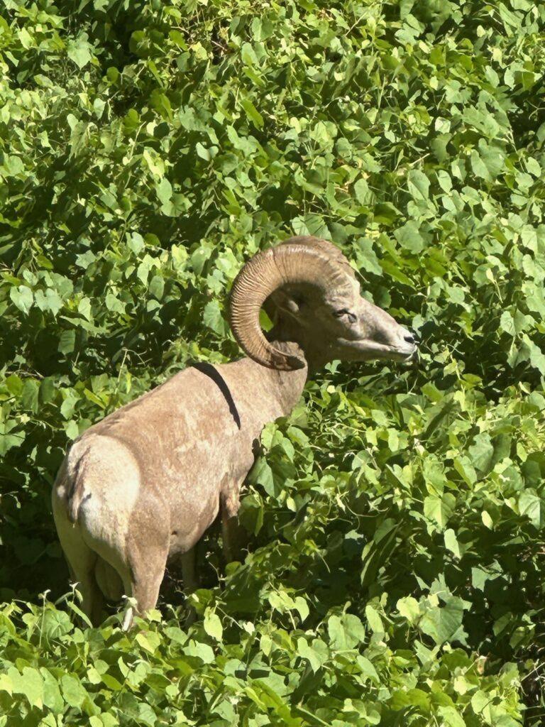
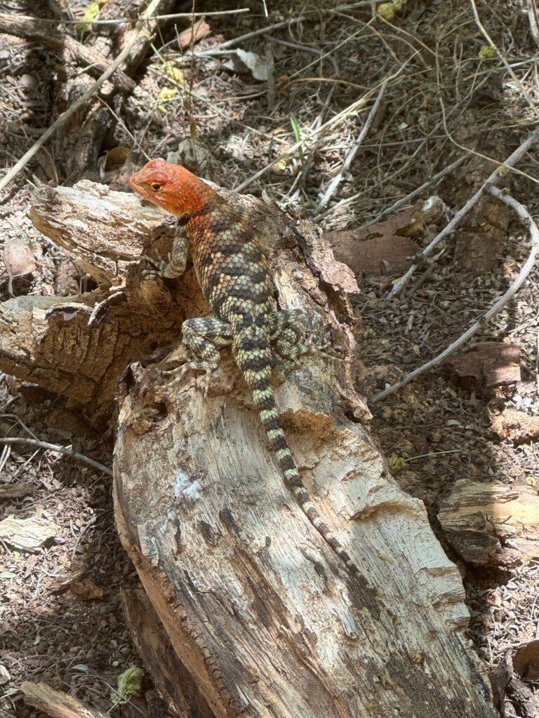
We enjoyed all of the wildlife also. We saw a massive big horn sheep ram, lizards, lots of bird species, fish, frogs, and bats. In fact, I have never seen so many bats before. Once dusk hit, they were everywhere and flying through our camp. Initially, it was disconcerting to have so many flying and so close. The second night I knew what to expect and was startled less!
The hike out. Our packs were slightly less since we consumed food, though we had to pack out our trash. I also brought out more water than I brought in. The hike out is all uphill. The last switch backs and climb to the trailhead was the hardest and steepest part, and at the end of the hike. It was the most amazing sense of accomplishment to reach the top. The culmination and completion of all of our months of training and planning.
All in all, this was an incredibly special trip. The physical accomplishment. Conquering the Mooney Falls climb and down climb. Being unplugged for three days. Immersing into a desert oasis. And experiencing it with top notch friends. We will most certainly never forget this trip!
Tell Me More
Difficulty: Strenuous.
Trail Stats: This is a hard one to report on. From Hualapai Hilltop Trailhead to the village of Supai, it is approximately 8 miles one way. Once you are past Supai village, you will come to the stretch along the river where you can set up camp. The campground is about ten miles from the trailhead and extends roughly one mile from the start of the campground to the top of Mooney Falls.
Once you have descended Mooney Falls, from there it is 5.31 miles to Beaver Falls, out and back, with 961 feet elevation gain.
Trail Finding: Hilltop to the campground, easy. Base of Mooney Falls to Beaver Falls, we did consult our AllTrails a couple of times since the flooding had made a few of the river crossings unclear. We probably would have found it with a short amount of wandering, but it’s nice to not have to do that.
Conditions: You name it, you will encounter it. Primarily packed dirt, rock surfaces, in and out of water, some slick mud along the river bank, ladders, and more.
Would I Repeat This: Potentially. This is a hard question to answer. It was one of the greatest hikes of my life, but with a big price tag. For $1000 and the significant time and effort to prepare and execute this, I may be inclined to shift those resources to a novel experience. Not because this experience was anything short of magnificent, but because I typically will seek a new hike over a repeat one if I have the option. I would love though to see the turquoise blue water, since it was muddy when we went.
Let’s Do This
Parking: Can be limited at Hilltop trailhead. I did read about people that were recommending to have caution about parking along the cliff side of the road due to the possibility of rock damage to vehicles.
Timing: Start early for the hike in and the hike out! The sun is intense. We set out for our descent around 7 AM. We stayed at Grand Canyon Caverns Inn to put us closer to the trailhead. This is the closest lodging, which was still over an hour from the trailhead. It took us about five hours to get in and similar to get out, this time included time for photos and rest breaks.
Grand Canyon Caverns Inn was a convenient spot to stay, albeit the rooms were run down and grounds were in disrepair. They did though have a 4 AM basic breakfast, which was great to get a little something more than yogurt in us before we set out.
When we broke camp and set out for our return trip, it was 4 AM once our boots hit the trail. Even with this early of a departure, the hardest part of the trail was in full sun. Take into consideration that the switchbacks and the steepest ascent is the last part of the trail to get you to the trailhead. The sun is hot and intense and you will be tired by that point.
Downloaded Map: Yes, recommended.
Fees: Currently, permits are $450 per person. Permits must be obtained through the Havasupai Tribe.
Nearby Fun
Trails: This is the only permitted hike at the Hilltop Trailhead and the sole reason you will be here
More Photos