Fisher Towers
Description
It crossed my mind when I started this post about Fisher Towers that perhaps I should check if there was a limit to how many photos I could upload on the page. Who knew that when I put this hike on our itinerary that it would unexpectedly become one of the most favorite we have ever done. Why do I not see more out there on this hike? It was an experience of phenomenally impressive scenery from the moment my feet hit the gravel from getting out of the car and through the entirety of the miles. This is a hike that has views for miles the ENTIRE time.
The drive from Green River, Utah set the tone for what was to come for a postcard worthy day. The road ran along the Colorado River, treating us to the reflection of the red cliffs in the flowing water. We stopped at the Dewey Suspension bridge, more on this in the ‘Nearby Fun’ section.
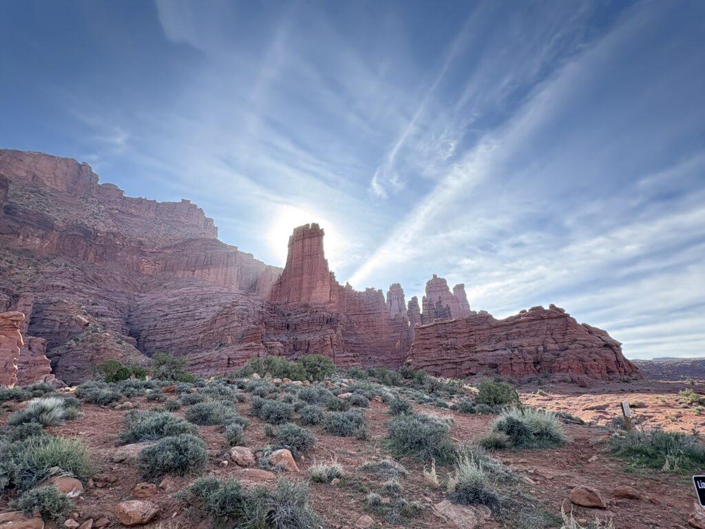
This hike was interesting because you start immediately with views galore. You do not have to go miles and miles to finally see what you set out to see. When we parked, the sun was rising and beams were shooting through the towers, just stunning.
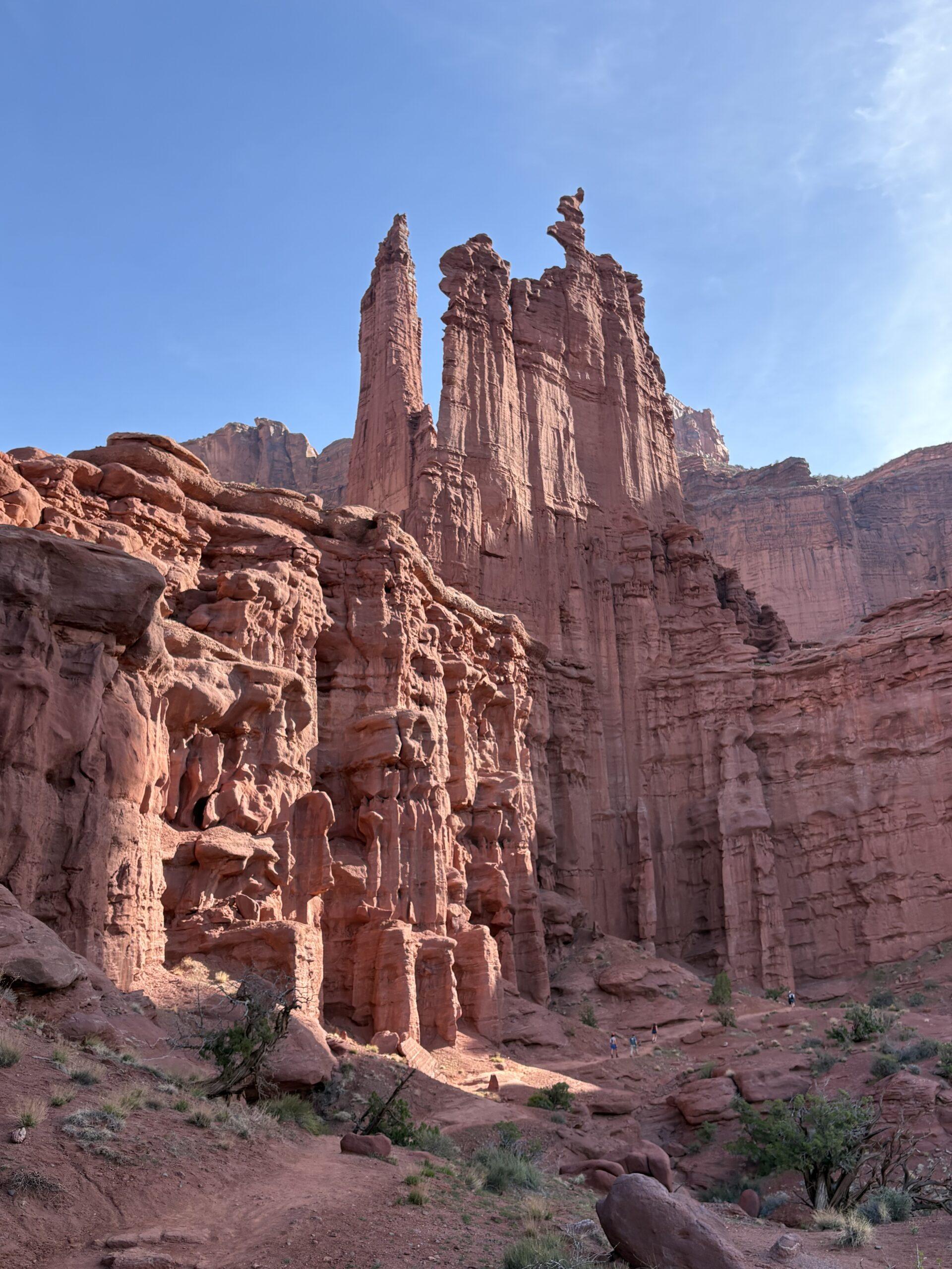
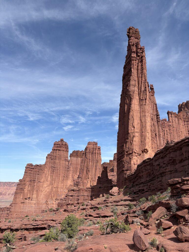
You descend from the parking lot, then start your climb to emerge right amidst the towers. Outside of being in the Narrows in Zion National Park, I can’t recall a time we have been right next to structures of such impressive height. Make sure to keep your eyes peeled for two things. One, watch for other hikers ahead. It takes a moment to notice them because they are so tiny in the distance. It gives you scale and perspective of the towers, some rising 900 feet. Second, you may see climbers summit in the tip tip top of some of the structures. I have included photos, but you won’t believe it unless you see it with your own eyes.
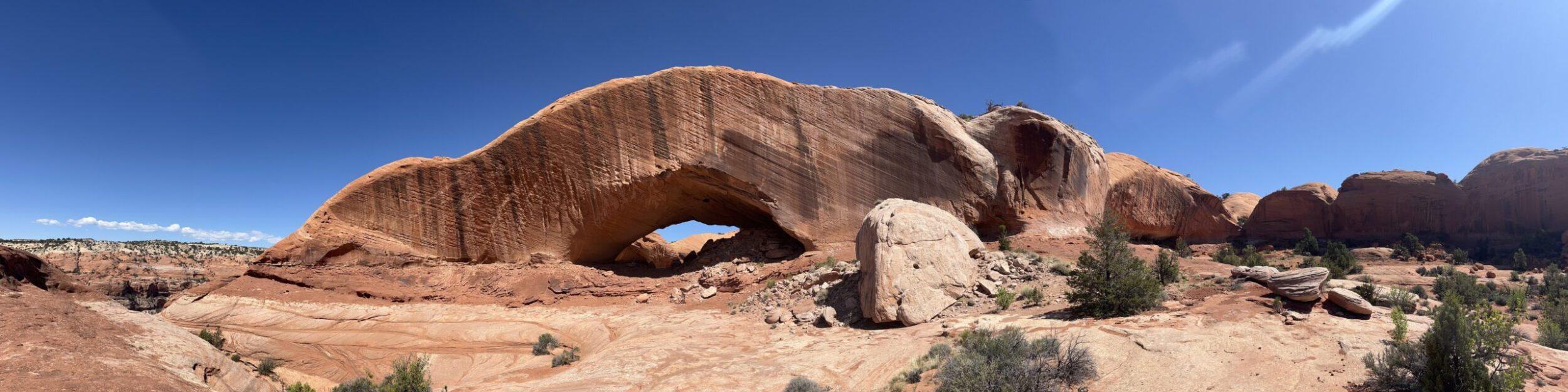
You hike along the base of the towers. There is short, well secured ladder you will need to descend to continue onward. Do not cut your hike short, continue out to the overlook. The 360 degree views are magnificent. The photos opportunities are innumerable.
If Mother Nature receives positive affirmations, she got a month’s worth from me on this hike. I was exclaiming the whole time about the beauty, grandeur, and change in views. Lots of oohs and ahhs for 4.6 miles. I should have had my husband count how many times I said something about how great the view was.
Tell Me More
Difficulty: Moderate, related to elevation gain.
Trail Stats: 4.6 miles, out and back, 1,509 feet elevation gain.
Trail Finding: Clear path finding.
Conditions: Slick rock, sandstone, packed trail.
Would I Repeat This: YES! ABSOLUTELY! WOULD LOVE TO!!
Let’s Do This
Parking: Two lots are available, the lower overflow lot has a connector trail to the main trail.
Timing: There was intermittent shade provided by the towers. However, still take into consideration that this will be a toasty hike mid-day when the sun is high in the sky.
Downloaded Map: Not needed, though referencing mileage and elevation changes while we hiked was interesting.
Fees: None.
Nearby Fun
Trails: Stop and see the remnants of the Dewey Bridge. It was unfortunately burned in a wildfire, but you can still see the cable and towers remaining. It was built in 1916 and was one of the longest suspension bridges in Utah. Other nearby trails, Onion Creek and Amphitheater.
More Photos