The Citadel
Description
Redemption! The last time we were in Bears Ears National Monument, we had heard about the Citadel on our way to another hike. We did not have cell service or a map when we attempted it. We found the trail, but due to time constraints and not knowing where the ruins were, we aborted the mission and did not see the ruins. This year, we returned and had our victory of finding and exploring the Citadel!
Take Cigarette Springs Road and don’t miss the left turn off toward the parking area for the Citadel. If you reach the end of Cigarette Springs road, you have gone too far. The Cigarette Springs road itself is impassable when wet, when we went it was not too bad and was packed dirt. The turn off and road going to the Citadel is another story, do not attempt this without a capable, high clearance vehicle. When in doubt, make a stop at the Kane Gulch Ranger Station for intel on the road conditions.
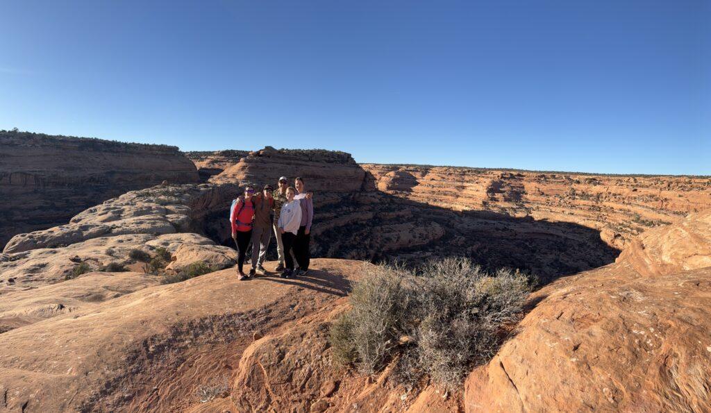
You will hike for most of the time on the top of the mesa. There are several spurs to lead to the edge to look down into Road Canyon. Take these and appreciate the impressive ledges, undulations, and expanse of the canyon. Also, bring a pair of binoculars to look down along the river, perhaps about one mile in, to see the Seven Kivas ruins. On this portion of the trail, the crytobiotic crust is pervasive. I don’t know that I have seen more of it and as healthy and tall. Learn more about the importance of cryptobiotic crust here and why you should not deviate from the trail onto the crust.
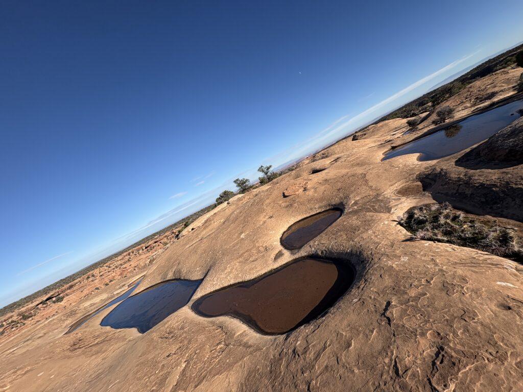
You will then continue onto a pothole dotted landscape. When we went, the potholes were filled with water, creating an other-worldly vibe. Now, traverse across the rock surface, following the cairns. The cairns are not frequently placed and the downloaded map is helpful for route finding.
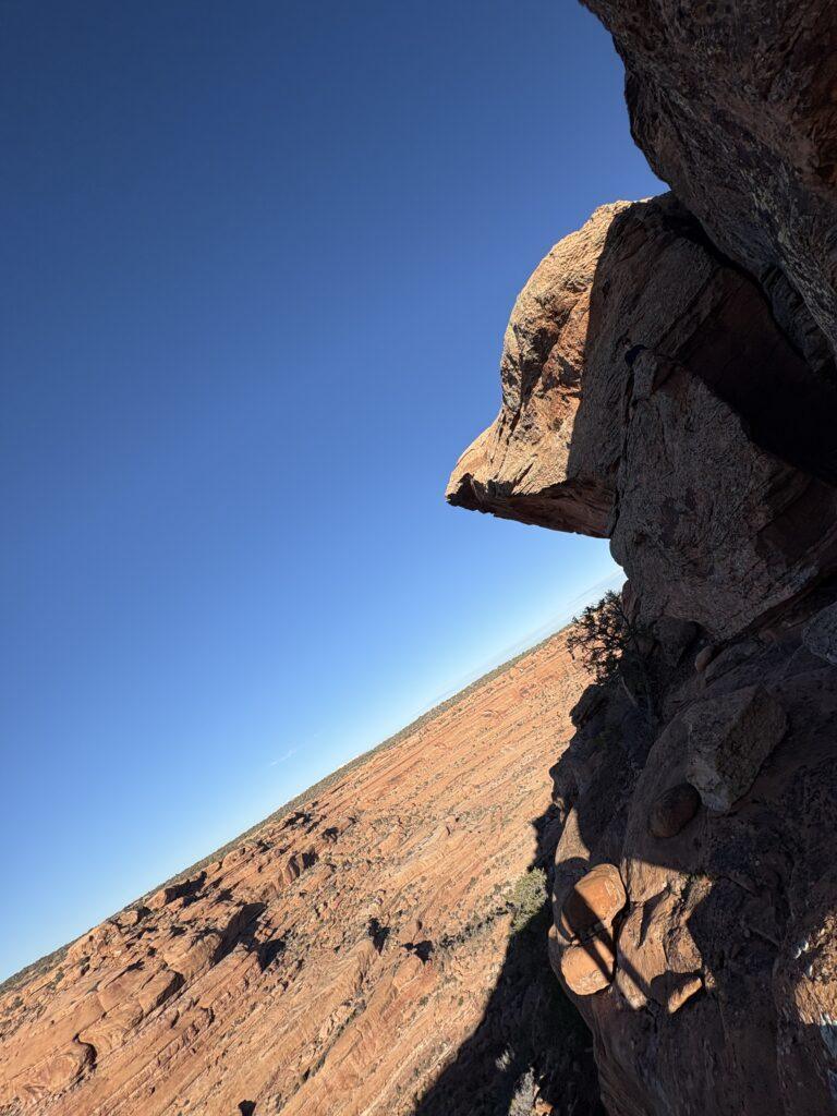
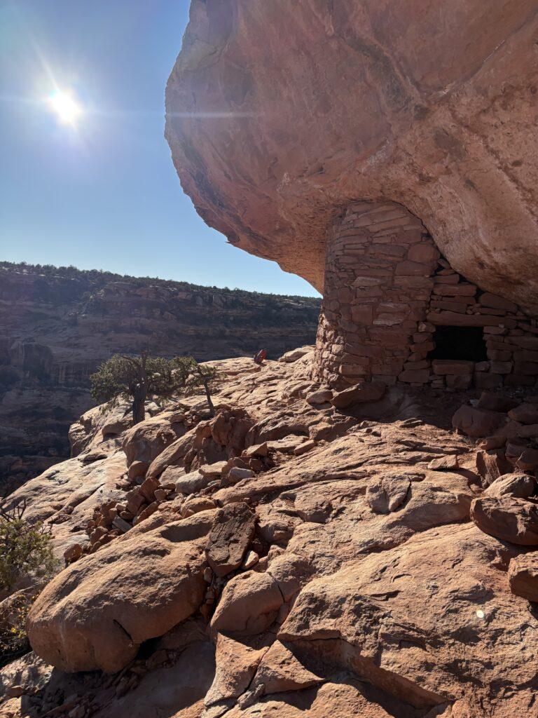
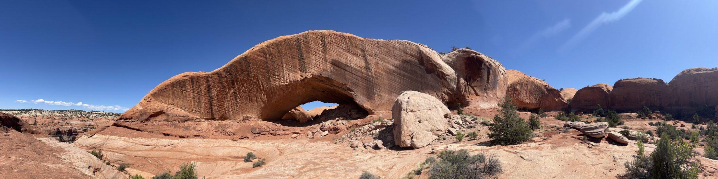
After a short distance weaving around the potholes, you suddenly emerge to a dramatic view of the sky bridge and mesa formation at the end of it. Head to hiker’s right, follow the cairns along the steep section to reach the bridge. Continue along the spine. At the end of the spine, climb up the crack that is marked by a cairn. Once you come up this crevasse, you will see where you are headed, The Citadel.
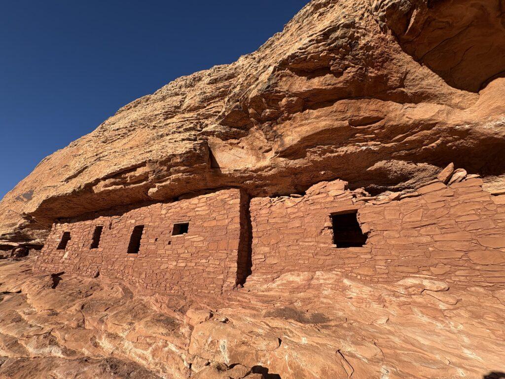
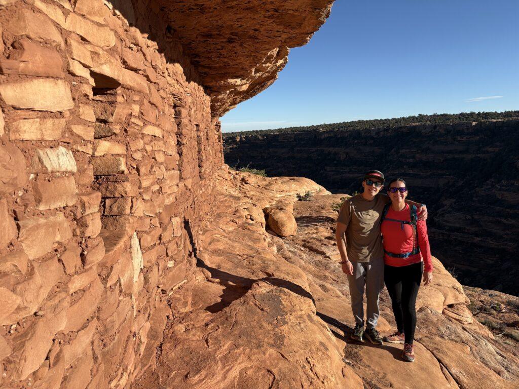
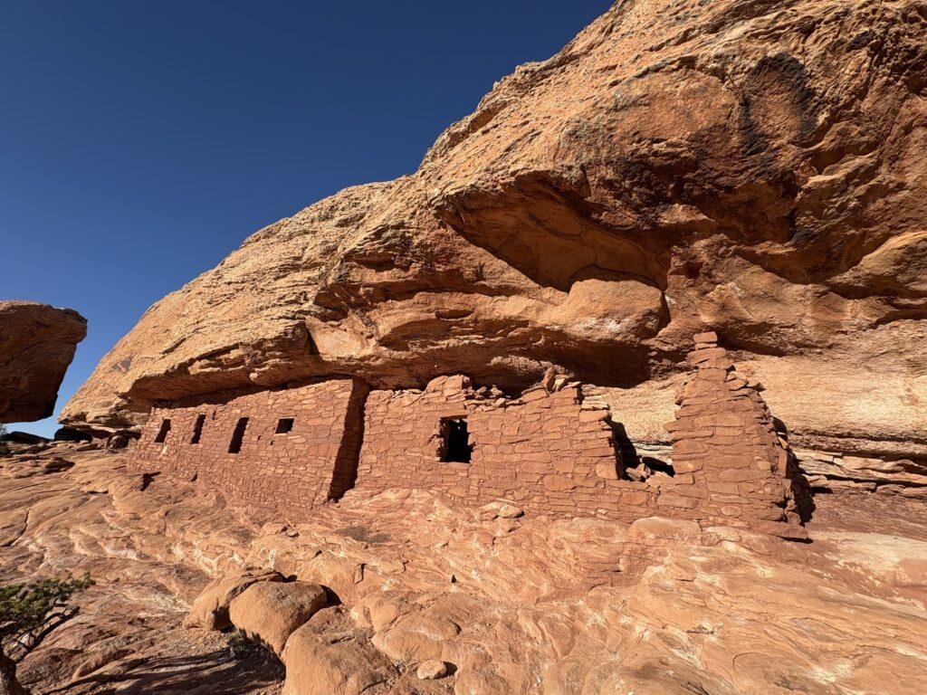
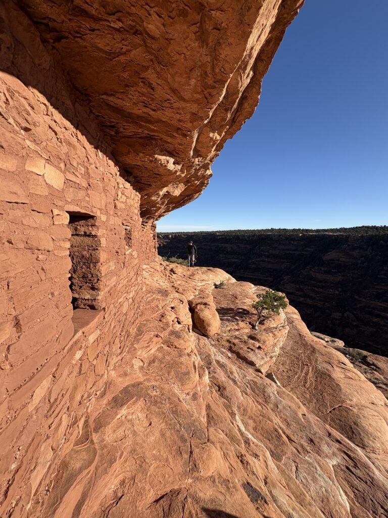
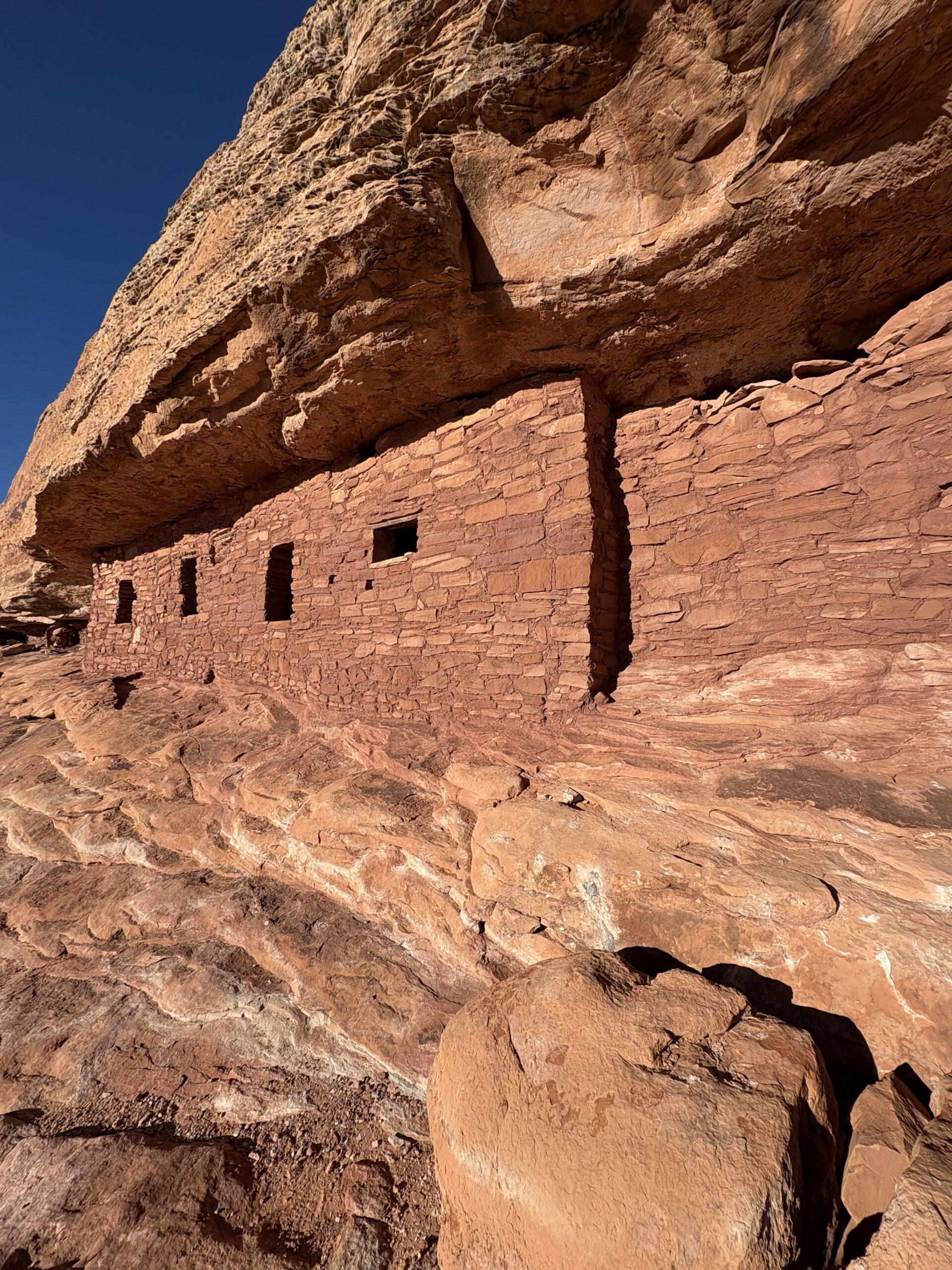
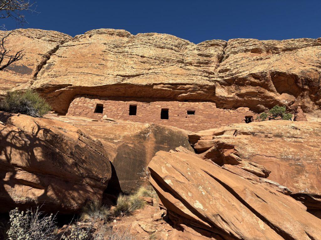
The Citadel is nearly at the top of the mesa. You can look into it, but do not enter it. The view is 360 degree, as far as you can see, and you will be transfixed in your awe of thinking of people living there, building it, providing food and water for themselves, and what is must have been like to call this dwelling home. This Ancestral Puebloan ruin is estimated to be around 1,000 years old.
Tell Me More
Difficulty: Moderate.
Trail Stats: 5.6 miles per AllTrails (we measured) 4.86 miles, out and back, 610 feet elevation gain.
Trail Finding: Straightforward to start and then more difficulty once you emerge onto the rocks, watch for the cairns. The hardest part is finding your way to the ruins themselves. Once you have the view of the sky bridge portion, head to your right, you will descend to the bridge on hikers right. It actually has you backtrack a short amount, follow the cairns. Once you cross the sky bridge, head upward and to the right on the rock mass ahead of you.
Conditions: Packed dirt (do not deviate from the trail on this section to avoid busting the crust), sandstone.
Would I Repeat This: Yep, and we have!
Let’s Do This
Parking: Plentiful.
Timing: You are fully exposed when you head out to the ruins. Have caution with attempting during icy or slippery conditions, wind, storms, or high temperatures.
Downloaded Map: Yes, I would recommend this.
Fees: Go to recreation.gov to purchase your day or multi-day use hiking pass.
Nearby Fun
Trails: Moonhouse Ruins (permit required), Moki Dugway, House on Fire, Mule Canyon and Cave Towers trails, and more!
More Photos