Cosmic Ashtray
Description
I have wanted to see the Cosmic Ashtray for a long time. Escalante is always a draw and this one has been on my radar. It is a long one and I had yet to subject my whole family to the distance, I knew it would be a challenging endeavor.
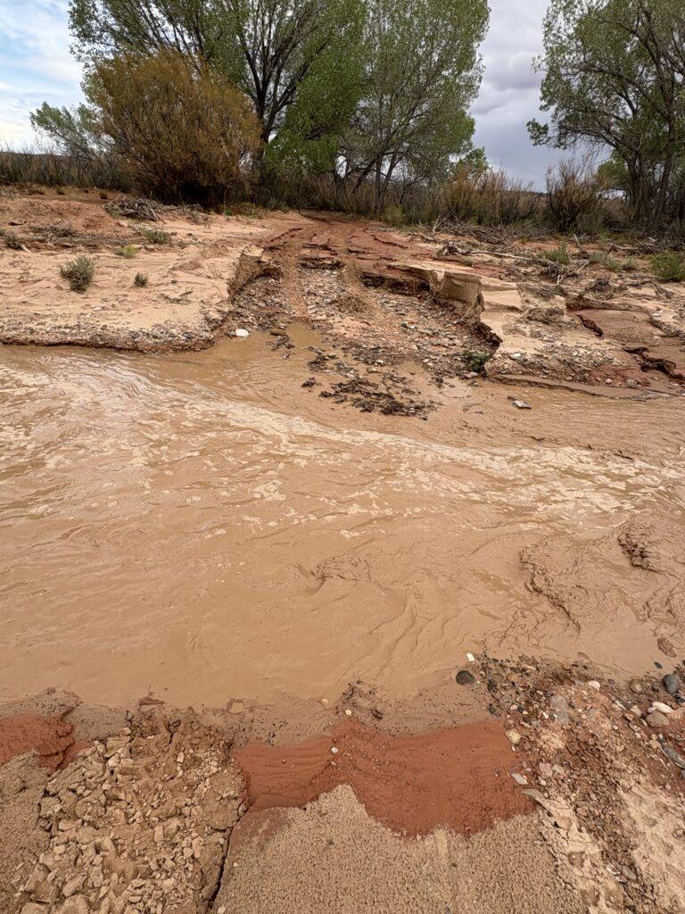
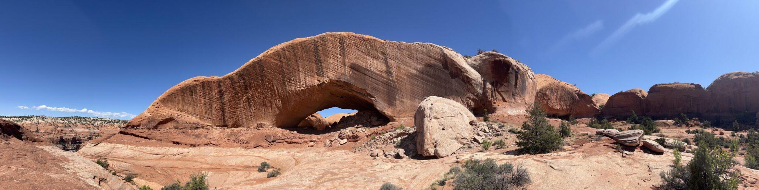
We arrived in Escalante and I found out through further research that with a high clearance 4×4 vehicle, you could drive to the trail turn off and cut your hike from nearly ten miles to just three. I was already scheming on what other hikes we could do that day with the extra time. We drove to the trailhead, signed in at the register, and then went to check out the stream we could hear running through Harris Wash. As we saw the water, and the subsequent washout of the road on the other side, our hike went back to ten miles and became our lone adventure for the day.
Initially, I was thinking that hiking on the 4×4 road would be boring. Turns out between the views and the ability to walk next to my best hiking companion and talk to one another easily, it was great. I enjoyed being able to get into a good pace and not have to watch the ground as much and focus more on the world around me.
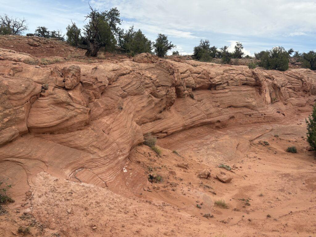
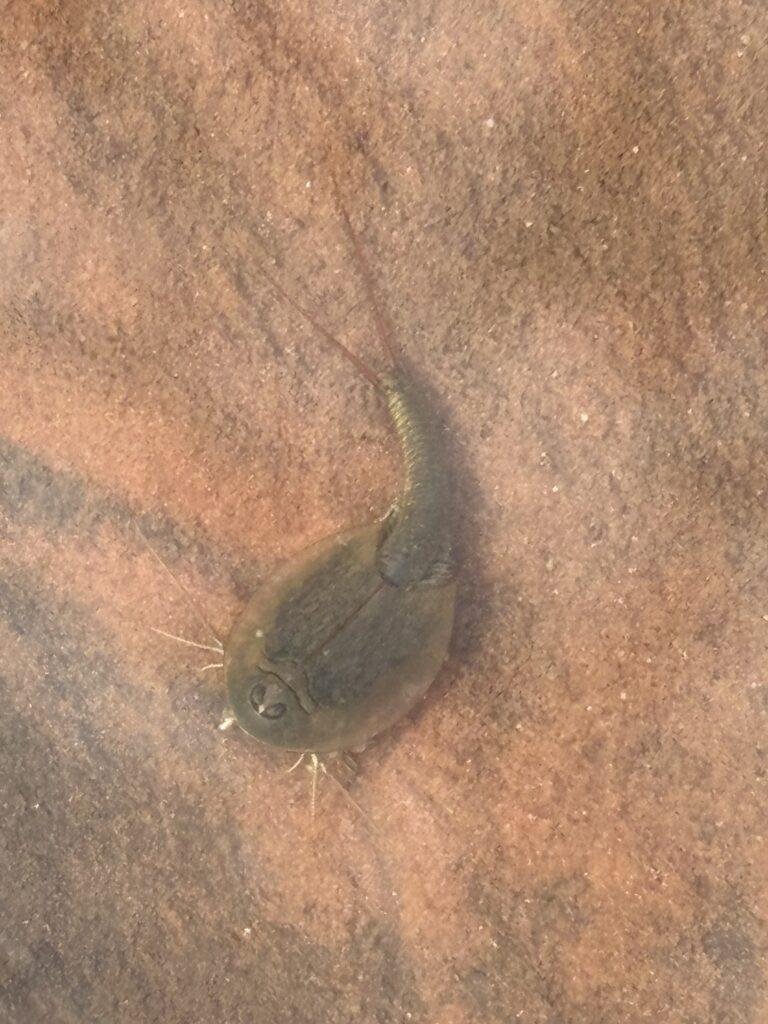
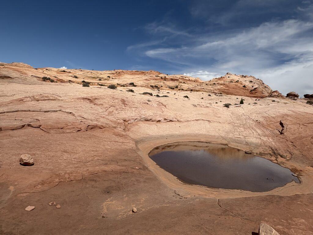
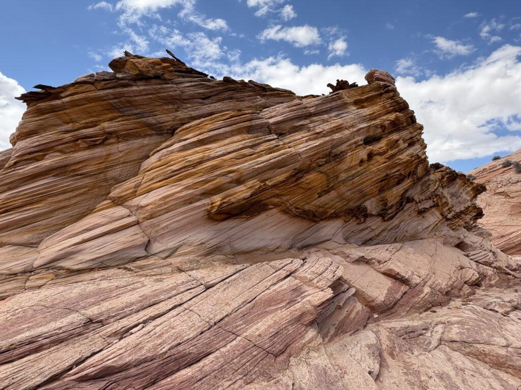
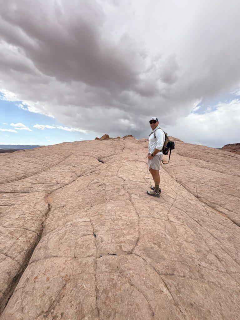
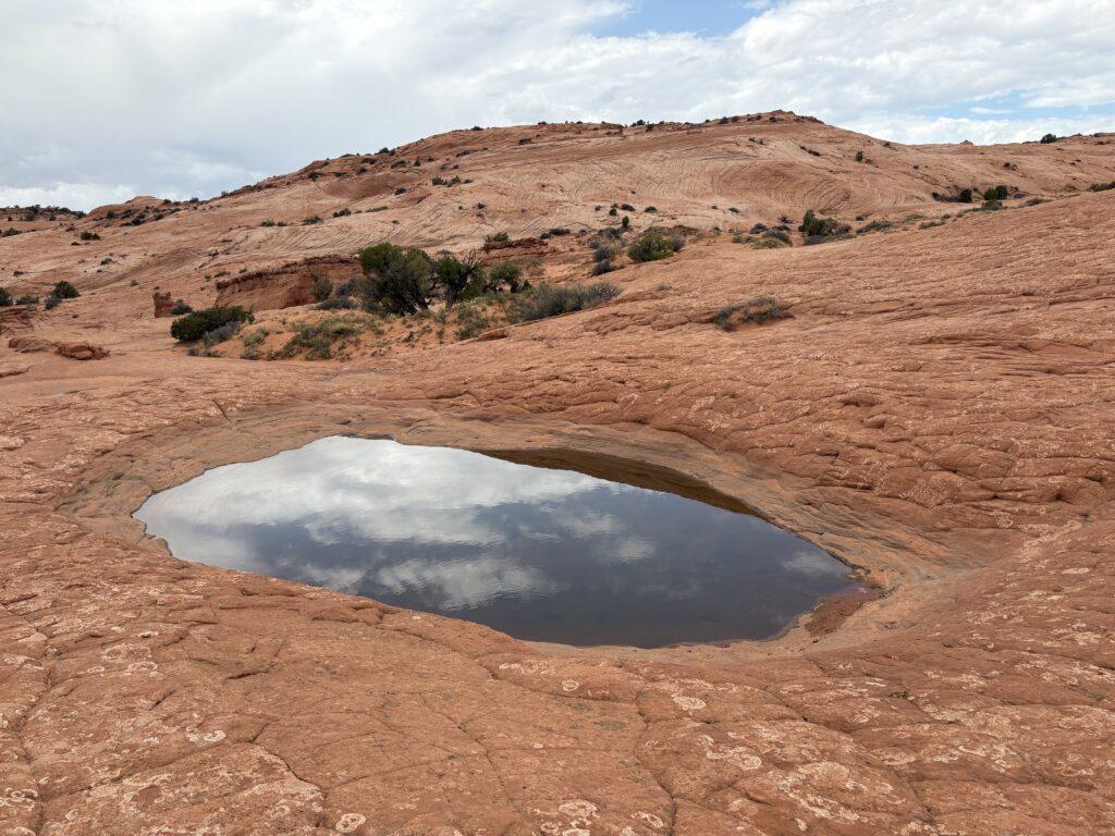
Once we hit the turn off to head upward to the Cosmic Ashtray, it was even more fun. I love hiking on the “reptile skin” rock. There were little pools with American Tadpole Shrimp, completely unexpected to see these tiny guys swimming around in the middle of the desert. We had never seen them before! They are a crustacean and resemble a horseshoe crab.
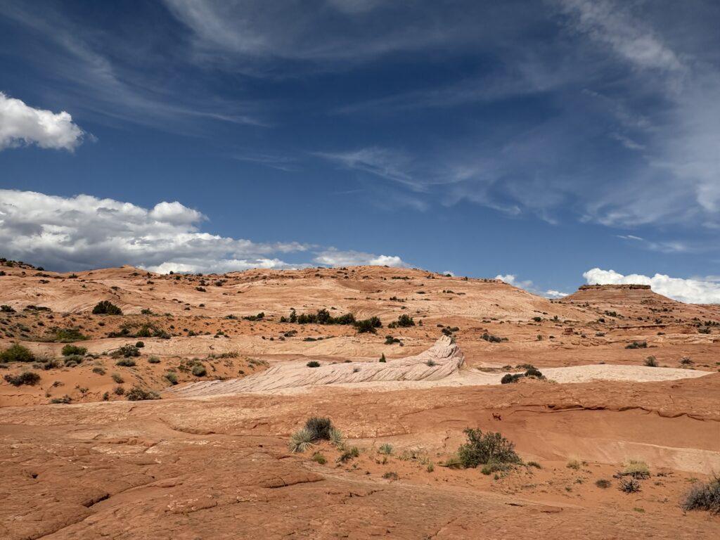
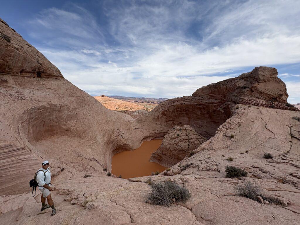
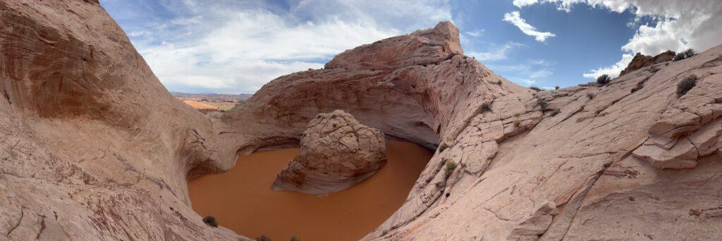
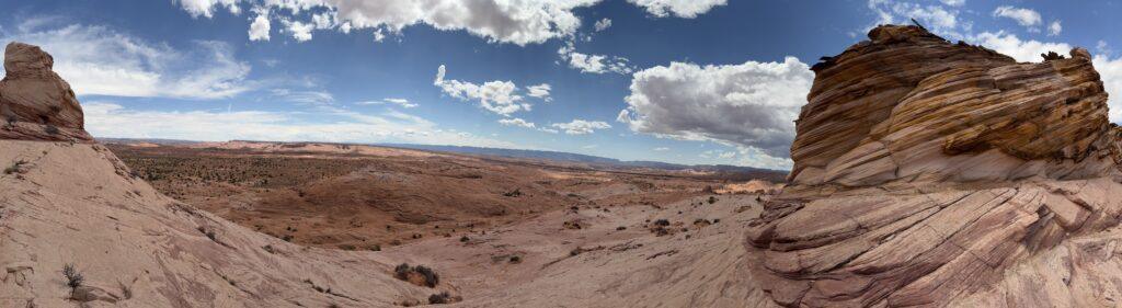
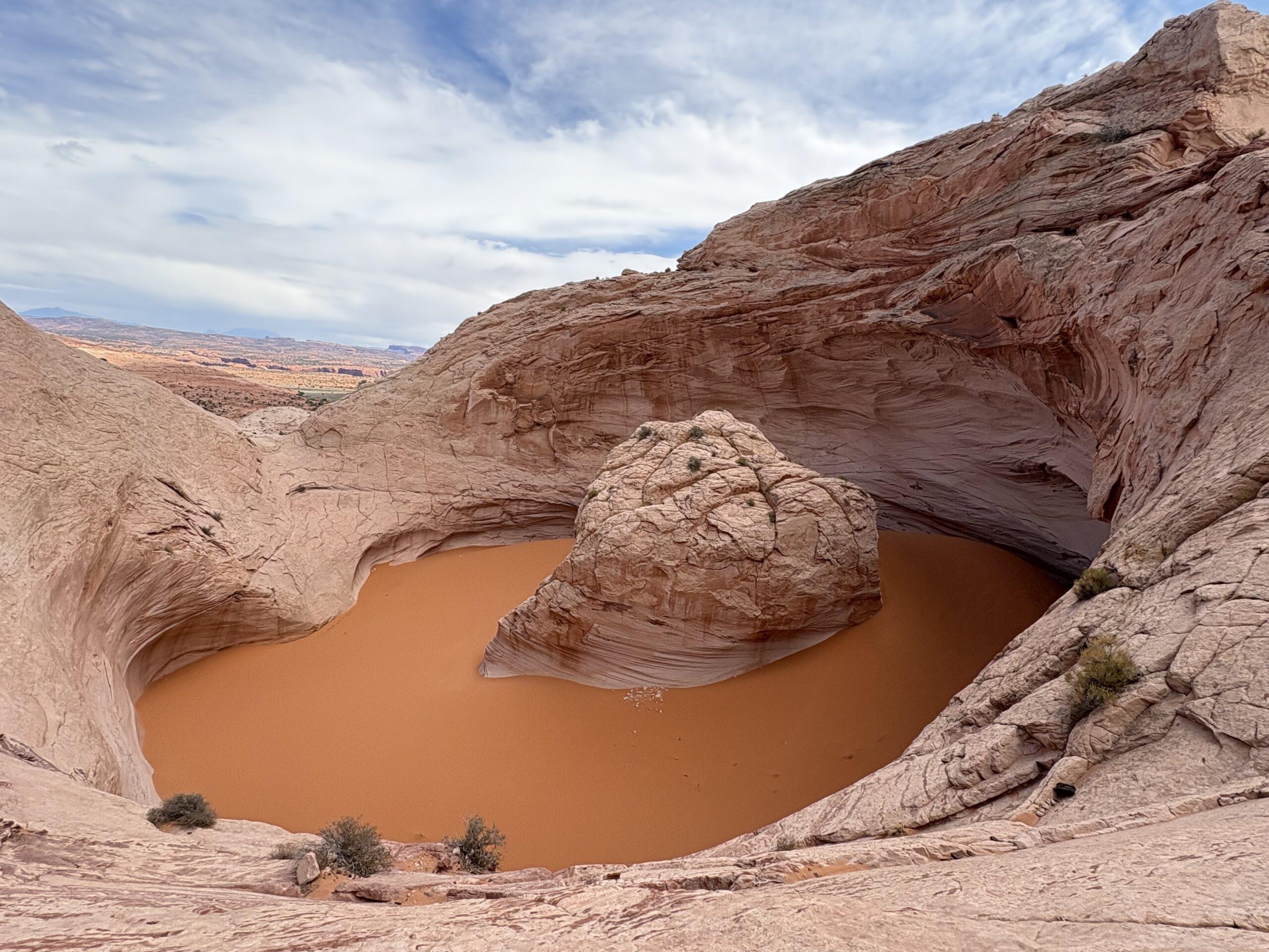
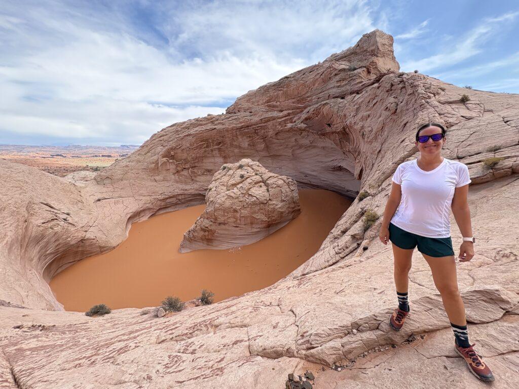
Continue upward past deep brown and black shards of charred looking rock. You will get to the top of the rise and enter a short winding path carved by water and, suddenly, the Cosmic Ashtray is before you. WOW. Completely worth the effort to see this giant formation. The sand in the bottom is so smooth it appears like water. In fact, we debated between ourselves for a bit whether it was sand or water. You also have an expansive view from the top, turn all around and anywhere you look you will see why Escalante is my favorite place in Utah. Beauty as far as the eye can see in any direction!
Tell Me More
Difficulty: Moderate.
Trail Stats: 9.1 miles, out and back, 967 feet elevation gain.
Trail Finding: Challenging but easily doable if you have a downloaded map.
Conditions: If you hike the full length of the trail, you are on a rocky and backed dirt access road. Once you have made the turn off for the last 1.5 mile portion, you are on sandstone and rock the whole time.
Would I Repeat This: Yes, it was so cool!
Let’s Do This
Parking: Small lot is present at the trailhead where the sign-in register is located.
Timing: Totally exposed, be aware of the length of time this will take and take adequate water if it will be hot and sunny.
Downloaded Map: Yes, the turn off from the access road is not clearly marked. In addition, once you have made the turn off, there is no trail and few, if any, cairns.
Fees: None.
Nearby Fun
Trails: Peekaboo and Spooky slot canyons, Devil’s Garden, 20 Mile Wash Dinosaur Trackway, Escalante Natural Bridge, Phipp’s Arch, Upper and Lower Calf Creek Falls.
More Photos