
Kolob Arch via LaVerkin Creek Trail
Description
We decided to visit Kolob Arch via the LaVerkin Creek Trail as a way to get some mileage in and test out some of our newer backpacking gear before an upcoming extended backpacking adventure. Young children and geography kept us closer to home, but now that we live here and our kids are more independent, we decided to get back into the overnight backpacking world.
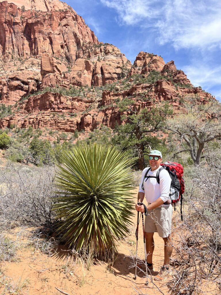
This trail was a good one to be able to trail for a longer distance and more elevation gain. We completed it with a one-night trip in mind, with packs and our gear weighing in around 25 pounds. We used our trekking poles, which I would recommend due to some loose terrain and also the incline.
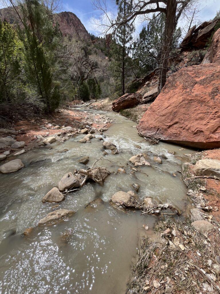
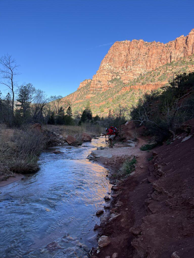
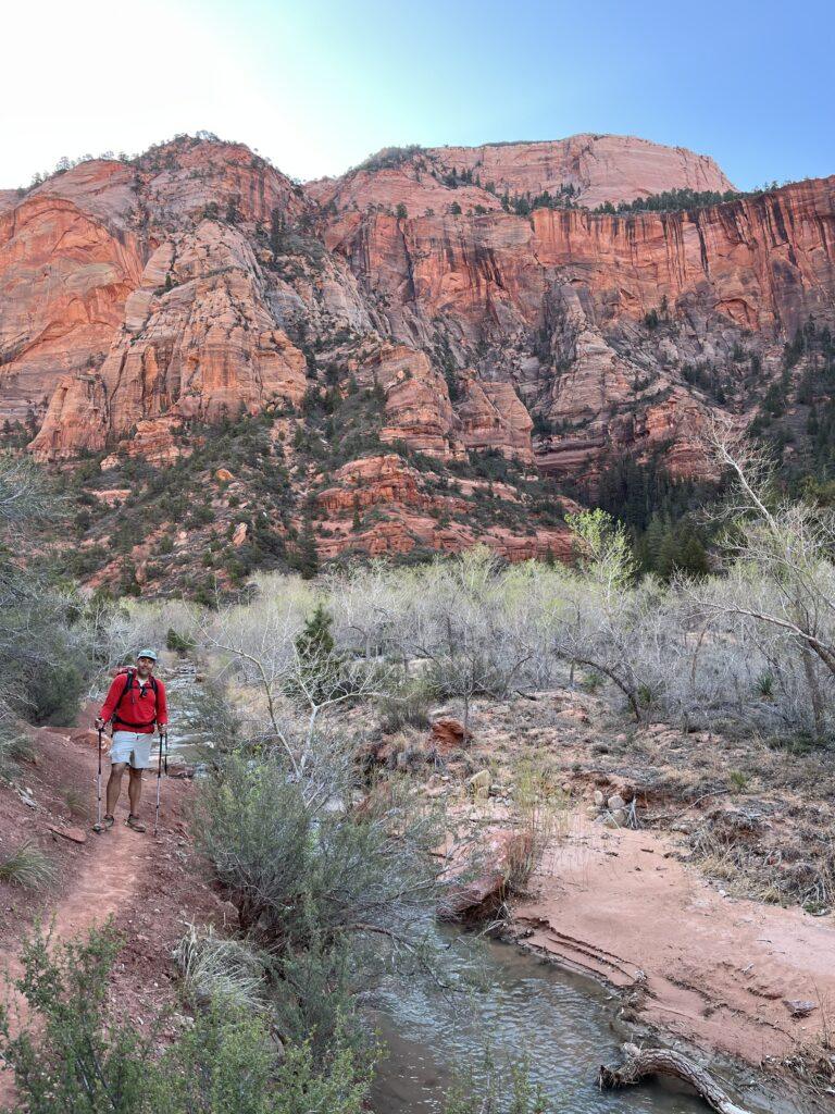
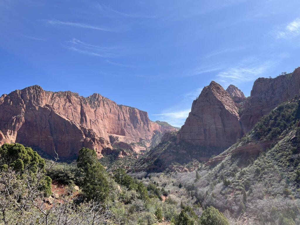
The trail begins at the Lee Pass Trailhead. Your descent begins immediately. You pass through trees and some meadowy areas. The Kolob Canyons towering cliffs and rock formations impressively rise all around you as you eventually reach the valley floor and LaVerkin Creek. The water is a beautiful blue grey color and provided a relaxing background noise as we would further towards Kolob Arch.
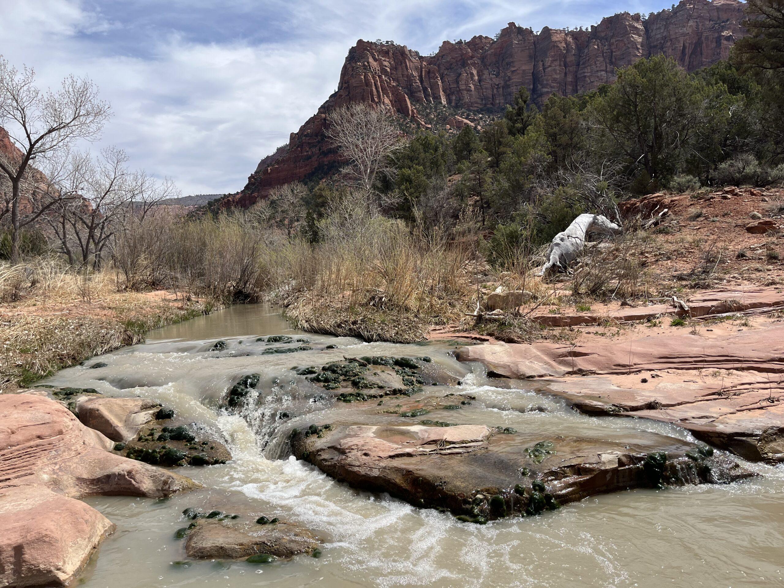
There are sections of sand once you are along the creek, as well as evidence of a big, muddy mess on sections of the trail as we decided. For the most part, the trail was mainly packed dirt.
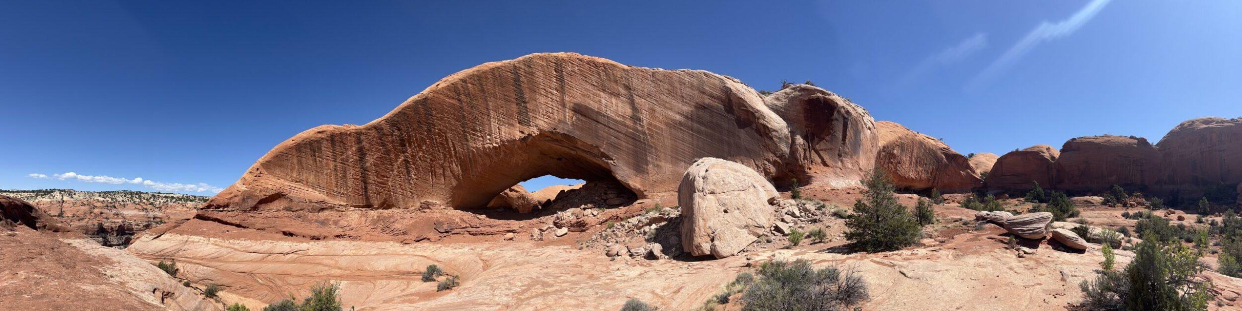
Kolob Arch is down a side trail and is high up on the side of the cliff. Despite reading that is one of the world’s largest arches, it was a bit underwhelming due to the distance away it was from the viewpoint. If I had hiked in for just the day, I may have been a tad disappointed, but then again, the rest of the trail was quite beautiful.
We camped at site 11, which is about 10 minutes past the trail split for the arch. It was along the river and a beautiful place to call home for the night. Per the ranger, we took the proper precautions to hang our food. Also, there is a water source for filtering that is just past site 10 as soon as you cross the creek. Do not drink from or filter from LaVerkin Creek due to Cyanobacteria.
All in all, it was a great experience. More information to come on gear reviews after our recent upgrades and tests of the new and improved backpacking equipment.
Tell Me More
Difficulty: Strenuous.
Trail Stats: 13.9 miles, out and back, 1,669 elevation gain.
Trail Finding: Relatively easy.
Conditions: Mostly packed dirt, some section of sand once you are along the creek.
Would I Repeat This: Maybe, it’s a doozy and not really a day hike experience. I would probably backpack it again.
Let’s Do This
Parking: Small lot available at the Lee Pass Trailhead.
Timing: Due to the strenuous nature of the hike out and intermittent shade, take consideration on the time of day you hike out.
Also, we saw areas of past flooding around La Verkin Creek. If rain is forecasted, inquire about flooding potential with the Ranger when you pick up your permit at the Wilderness Desk.
Downloaded Map: Not absolutely necessary, though always nice to know how much longer, as well as be able to congratulate yourself on the mileage and elevation achievement.
Fees: This hike is within Zion National Park. You will need to pay the entrance fee or show your National Parks Annual Pass. In addition, you will need to purchase an advance or walk-in permit for overnight backpacking, and pick it up at the Wilderness Desk. Please be aware, as of April 2025, the Wilderness Desk at the Kolob Canyons Visitor Center is closed and not anticipated to re-open. You must pick up the permit the day before or the day of at the Wilderness Desk at the main Zion National Park Visitor Center in Springdale, Utah. Yes, this adds a lot more driving.
Permits can be purchased in advance using the link below, though you must still pick up in person. Or, as we did since we are local and were able to do a more spontaneous trip, you can purchase a ‘walk-in’ permit, where you show up to the desk and book what is available.
Nearby Fun
Trails: Taylor Creek andTimber Creek Overlook Trails are great options in Kolob Canyons, and the scenic drive is beautiful as well.
More Photos